

Forecast for the Uintas Area Mountains

Sunday morning, December 17, 2017
In general the avalanche danger is LOW and human triggered avalanches are unlikely.
 Weather and Snow
Clouds are clearing and temperatures crashed into the single digits overnight, in the wake of yesterday's underwhelming storm that only delivered about an inch of light density snow. Winds are nearly nonexistent, blowing in the single digits even along the highest ridges. Despite the lack of fresh snow, total snow depths are hanging tough, still hovering in the two foot range.
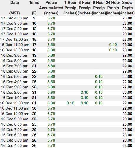
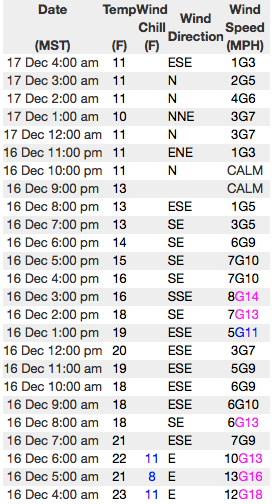
Above are 24 hour temperatures and snow depth from Trial Lake along with winds and temperatures from Windy Peak. More remote Uinta weather stations are found here
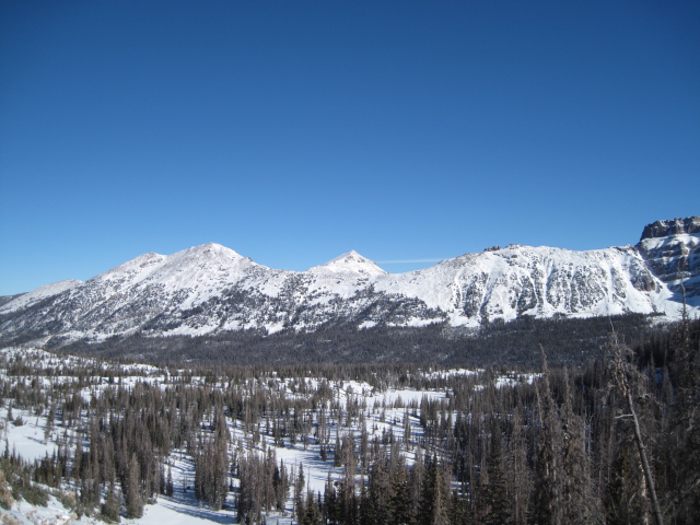
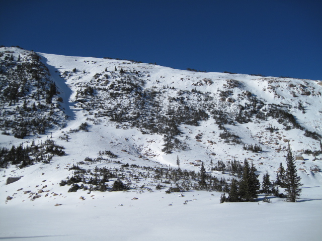
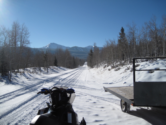
You know the drill.... white from far, but far from white. Road rides and rock free, grassy meadows are the only game in town. (Scroggin photos)
Ted and Weston were out and about this week and their trip reports and insights are found here.
 Recent Avalanches
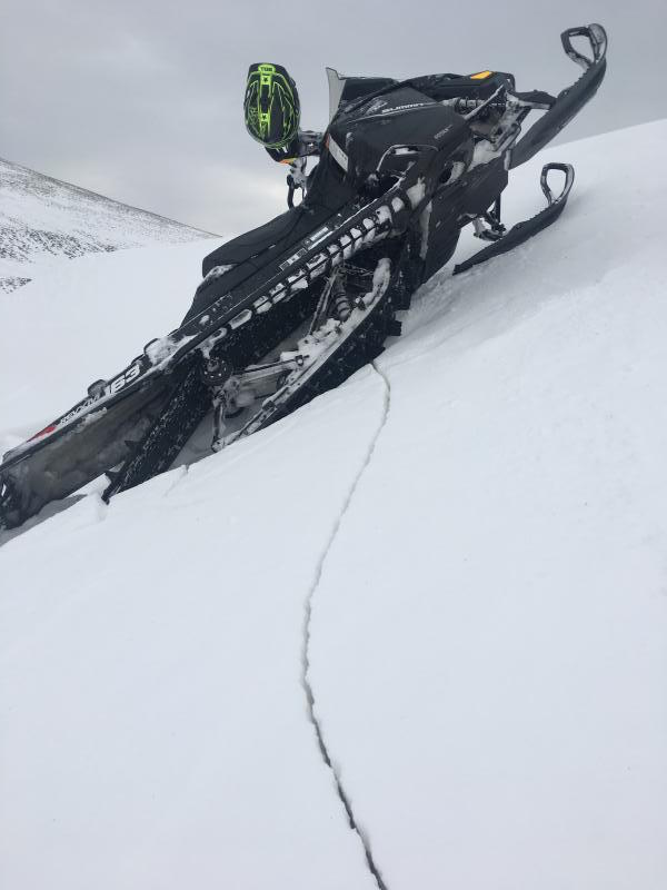
No recent avalanche activity to report. However, Weston did find this stout, hard wind slab which cracked under his sled track on a steep, upper elevation, wind drifted slope. (Weston D photo)

Wind Drifted Snow
Description
Yesterday's storm, or lack there of, didn't tip the scales and the avalanche danger is pretty straight-forward. However, the Uinta's are a big range and I bet if you went avalanche hunting you could stumble on a rogue wind drift or two. The good news is... these are spotty at best and confined to steep, shady, slopes along the leeward side of high elevation ridgelines. The bad news... triggering a slide in shallow, low tide conditions greatly increases your chances of slamming into a season ending rock or stump.
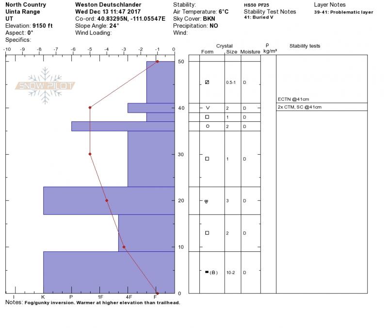
Weston was in upper Weber Canyon this week and found a snowpack that's a bit complicated, but comfortable in its own skin for the moment. (Weston D photo)
Additional Information
High pressure builds today through early this week, giving us clear skies and light northwest winds. Temperatures climb into the mid 20's and dip into the teens overnight. The next storm system approaches from the northwest by midweek. Given the track record of recent storms I'm not completely sold on a big, pattern changing storm. However, we should at least see colder temperatures and a better chance for snow developing late Wednesday.
General Announcements
The information in this advisory expires 24 hours after the date and time posted, but will be updated by 7:00 AM Wednesday December 20, 2017.
If you're getting out and about, please let me know what you're seeing especially if you see or trigger and avalanche. I can be reached at [email protected] or 801-231-2170
It's also a good time to set up one of our very popular avalanche awareness classes. Reach out to me and I'll make it happen.
This information does not apply to developed ski areas or highways where avalanche control is normally done. This advisory is from the U.S.D.A. Forest Service, which is solely responsible for its content. This advisory describes general avalanche conditions and local variations always occur.