Forecast for the Logan Area Mountains

Thursday morning, April 27, 2017
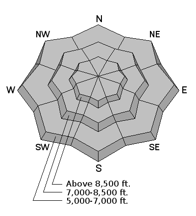
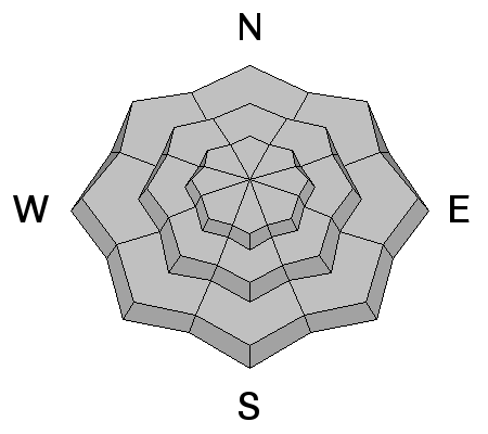
Evaluate snow and terrain carefully. Avoid drifted terrain at upper elevations, steep slopes with saturated fresh snow, and overhanging ridge top cornices.


Evaluate snow and terrain carefully. Avoid drifted terrain at upper elevations, steep slopes with saturated fresh snow, and overhanging ridge top cornices.

Great news… so far there haven’t been any avalanche fatalities in Utah this winter! It has been 26 years since we’ve had a fatality-free winter. Let’s keep it that way and stay safe this spring. Our goal is for everyone to enjoy the Greatest Snow on Earth and come home safe every day. The final regular advisory will be this Sunday, April 16. For the rest of the month we'll issue updates when conditions change significantly; however, we will discontinue issuing regular advisories and avalanche danger ratings after Sunday.
The Tony Grove Snotel at 8400' reports 23 °F, 8" of new snow in the last 24 hrs, and 3.2" of SWE (Snow Water Equivalent) since Monday. There is 109" of total snow, with 164% of average SWE. It's 16 °F this morning at the 9700' CSI Logan Peak weather station and the wind sensor appears rimed or encased by ice. It's 24 degrees at the UDOT hwy 89 summit weather station and a 16 mph west wind is blowing. West and northwest winds were strong last night, with hourly average wind speeds in the upper twenties and gusts in the forties. The fresh snow is creating elevated avalanche conditions in the backcountry, with wind slab and storm snow avalanches possible at upper elevations and wet loose avalanches entraining significant fresh moist snow likely in steep terrain.
A skier reported triggering a wet loose avalanche yesterday evening (4/26/17) on a steep mid elevation slope in Providence Canyon in the north facing Dog Leg avalanche path. View Report
Although we will be shutting down regular operations, we will continue to post recent avalanche activity and observations through the end of the month as we receive them, so please do continue to send them to us. You can check the latest observations here. We also follow avalanche-related activity on Instagram - be sure to tag your photos with #utavy .

We almost always get several winter-like snow storms in April and May. Treat each storm just like you would in winter. Avalanches can occur within the new snow typically from 1) low density layers deposited during the storm, 2) high precipitation intensity during a storm and 3) from wind slabs created during the storm.
It's easy to test the new snow as you travel by jumping on small test slopes to see if they avalanche or just dig down with your hand to see how well the new snow is bonding. Snow can change dramatically in both space and time so never let your guard down. Especially avoid any steep slope with recent wind deposits, which are almost always dangerous.

When cold, dry snow becomes wet for the first time, it almost always means wet sluffs (loose snow that fans outward as it descends) and occasional wet slabs. Also, slabs can involve old snow when melt water percolates through a layered, winter snowpack for the first time especially after 3 days of strong melting combined with no refreeze at night. Luckily, wet avalanches usually don't last forever because after a few days of percolating melt water, all the layers in the snow disappear and the snow becomes homogenous and dense, turning into a stable summer-like snowpack. Typically, this cycle of instability maturing into stability occurs first on the south facing slopes in early spring, then progresses to the east and west facing slopes in mid spring and finally by late spring, the upper elevation north facing slopes go through a wet avalanche cycle. Finally, glide avalanches occur regularly in spring as the entire snowpack slides slowly on the ground like a glacier until they suddenly release into a full-depth avalanche. These occur regularly on steep rock slabs and occasionally on steep grassy slopes. Notorious glide avalanche locations include places Stairs Gulch or the rock slabs in Broads Fork, which you should always avoid in spring. Avoid crossing under any slopes with telltale glide cracks in the snowpack. Remember they come down randomly, even at night.
The bottom line for wet avalanches:
Get out early and get home early. Get off of--and out from underneath--any slope approaching 35 degrees or steeper when the snow becomes wet enough to not support your weight. Warning signs may include:
Any of these signs mean it's time to head home, or at least change to an aspect with cooler snow. Remember, even "smaller" slides can be dangerous in high-consequence terrain, such as above a terrain trap, trees, rocks, cliffs or a long, large avalanche path. Plan your trip to have a safe exit back to the car. (You can always click on the "I" button next to the avalanche problem icon for more information.)

As you travel in the mountains, keep a few things in mind:
Do you buy groceries at Smiths? When you register your Smith’s rewards card with their Community Rewards program, they will donate to the Utah Avalanche Center whenever you make a purchase. It's easy, only takes a minute, and doesn't cost you anything. Details here.
If you sign up for AmazonSmile and designate the Utah Avalanche Center as your favorite charity, they will donate a portion of everything you spend to the UAC. It doesn't cost you a penny and we'd really appreciate the help.
Your information can save lives. If you see anything we should know please help us out by submitting snow and avalanche observations. You can call us at 801-524-5304, email by clicking HERE, or include @utavy in your Instagram. In the Logan Area you can reach me at 435-757-7578
This advisory is from the U.S.D.A. Forest Service, which is solely responsible for its content. This advisory describes general avalanche conditions and local variations always exist.