Planned Website Outage: The UAC website will be down for maintenance on June 17 from 2:00 - 7:00 PM MT.

Observation: White Pine

Observation Date
4/26/2017
Observer Name
Tyler Falk
Region
Salt Lake » Little Cottonwood Canyon » White Pine
Location Name or Route
White Pine
Weather
Sky
Overcast
Weather Comments
Overcast changing to obscured skys at times today during the morning hours. Overnight lows last night in the high teens at 10k. Calm winds in most loations with light winds on 10k ridgeines. A few light snow showers off and on which did not add up to anything.
Snow Characteristics
New Snow Depth
14"
New Snow Density
Medium
Snow Surface Conditions
Powder
Dense Loose
Damp
Snow Characteristics Comments

The new snow settled out to about 14". Alta received around 26" of new snow with 2.65" of SWE which gave us another 10% density storm. It was easy to make a snowball at and below 9500' even on North aspects after noon today. Above that only north aspects held good dry snow. Loose wet point releases were occurring on slopes with a East, South and West component. Below 8500' this morning a thick crust was found from the warm temps on Tuesday. The warm temps later in the afternoon today broke that crust down which should be re forming tonight. Some shallow 4" windslabs noticed just off 10k ridgelines on East and Northeast but seamed limited due to limited available snow for transport which was a bit heavier and harder to blow around. Snowtel sites are back on the rise for percent of median. As of 4/26...

Snowbird- 133%

Mill D BCC- 126%

Thaynes Canyon-137%

Brighton-128%

Timp Divide- 152%

Red Flags
Red Flags
Recent Avalanches
Heavy Snowfall
Rapid Warming
Red Flags Comments
2.65" of water weight since the 24th at Alta. There was a natural cycle which seamed to happen sometime midmorning yestarday. A number of soft slab avalanches from yestarday were observed on NE and E aspects. Warming today into the low 40's at many trailhead elevations.
Avalanche Problem #1
Problem
Wind Drifted Snow
Trend
Increasing Danger
Problem #1 Comments

Alta received 8" of snow overnight from the 26th into the 27th and the noaa forecasted snow totals from last night though the next 48 hours have backed off . But IF the forecast confirms with the higher amounts over the next few days we could get up the 35" of new snow in Upper LCC with gusts easily into the 50's. We will likely see wind slabs on typical aspects from a NW flow over the next few days. Colder temps with highs at Alta in the 20's and lows in the teens will likely give us lower density snow which will probably be easily transported. If these snow totals and wind happen I would expect another round of natural avalanches and considerable to high avalanche danger through Saturday for wind and storm slabs. If not and we only pick minimal amounts of snow I would go with moderate danger out there.

Avalanche Problem #2
Problem
Wet Snow
Trend
Same
Problem #2 Comments

If we do not get the snow forecasted and get warmer temps with clearing skys we could see some wet slab activity on the melt freeze crusts in places where free water can run.

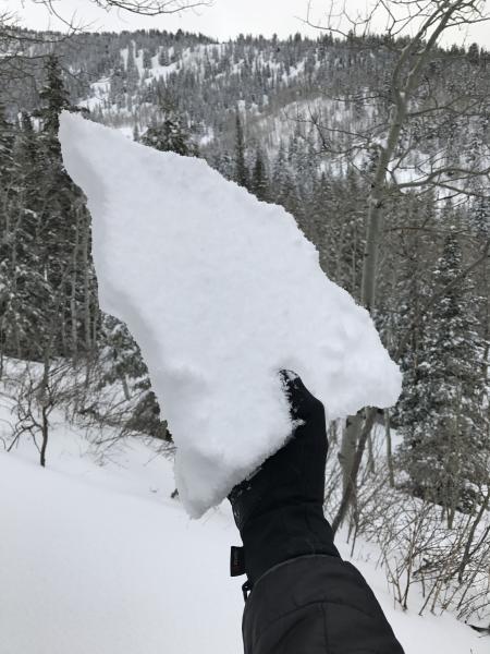
Pic 1. Heat crust in the morning down low from Tuesdays warm temps.

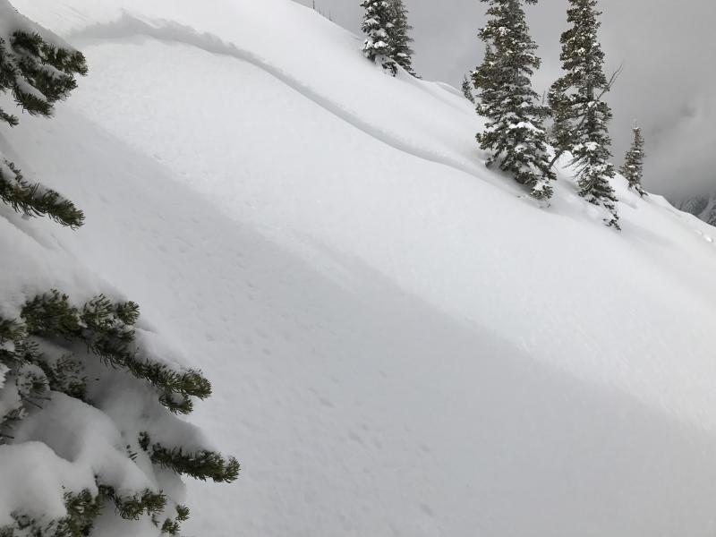
Pic 2. Storm Slab from Tuesdays cycle. SS-N-R1-D1

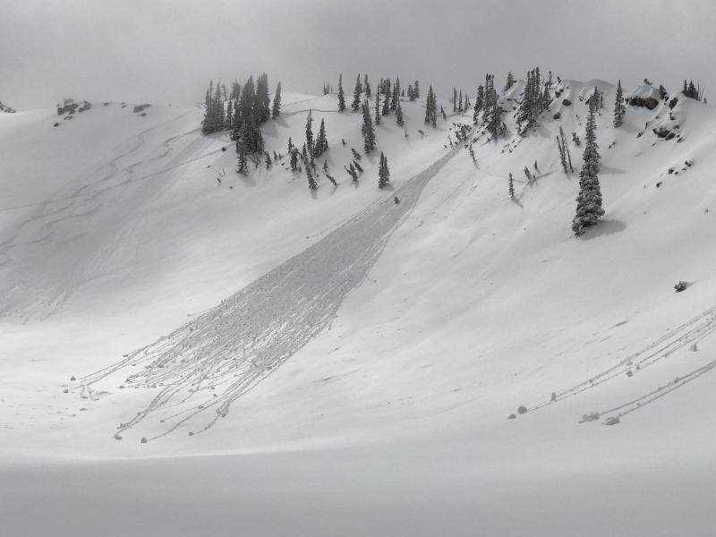
Pic 3. Loose Wet Point Release at 10k on East aspect.

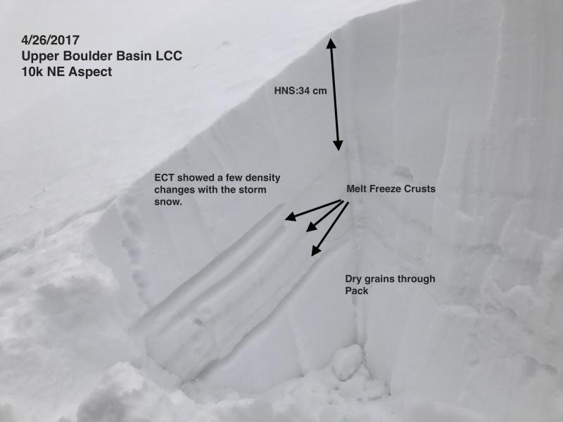
Pic 4. Quick pit on NE @ 10k

Today's Observed Danger Rating
Considerable
Tomorrows Estimated Danger Rating
Considerable