

Forecast for the Logan Area Mountains

Wednesday morning, April 5, 2017
Backcountry snow is stable, and the avalanche danger is LOW. There is a risk of uncontrolled slides and serious falls on steep slopes with slick, rock-hard snow. Shallow triggered wind slabs are possible on drifted upper elevation slopes and wet loose avalanches will become more likely in steep sunny terrain as temperatures warm. Use normal caution.

 Special Announcements
UAC Gear Sale Fundraiser: We still have some donated gear and certificates left over from the season. Want a guided rock climbing or canyoneering trip in Moab? How about a new pair of skis for some spring ski missions? Check out our gear sale photo album to see if we have what you need. This is a fundraising sale for the Utah Avalanche Center. All proceeds benefit avalanche forecasting and education. Click here to visit the sale!
 Weather and Snow
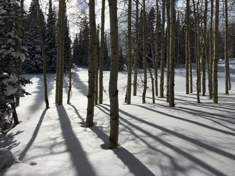
Last night was clear and cold, snow is stable, and fine spring conditions exist in the backcountry. The Tony Grove Snotel reports 22 °F and there's 103" of total snow, with 143% of average SWE (Snow Water Equivalent) at 8400'. A 17 mph west wind is blowing at the CSI Logan Peak weather station and it's 19 °F. Solid snow, capped by an inch or two of creamy powder at upper elevations, is smooth and stable. Snow is so hard that there's a risk of uncontrolled slides and serious falls. Some steep slopes might require crampons and an ice axe to ascend safely. Triggered shallow wind slabs are possible near ridge-lines in extreme upper elevation terrain, and warming daytime temperatures will create wet loose avalanche potential on steep sunny slopes in the next couple days.
 Recent Avalanches
Other than expected wet loose activity, no backcountry avalanches were reported in the Logan Zone over the weekend.
Normal Caution
Description
Triggered shallow wind slab avalanches are possible on steep slopes in drifted terrain at upper elevations.
- Avoid drifted snow on the lee side of ridges and in and around terrain features like gullies, scoops, sub-ridges, and cliff-bands.
- Overhanging cornices can break further back than expected and trigger avalanches on slopes below.
- Glide avalanches and cornice falls can occur at any time, but are most likely in the heat of the day
Avalanches entraining fresh loose wet snow are possible with midday warmth on steep sunny slopes at upper and mid elevations.
- Watch for signs of wet instability like roller balls, pinwheels and natural sluffs under trees or rock outcroppings.
- Avoid being on or under steep slopes if fresh snow is saturated.
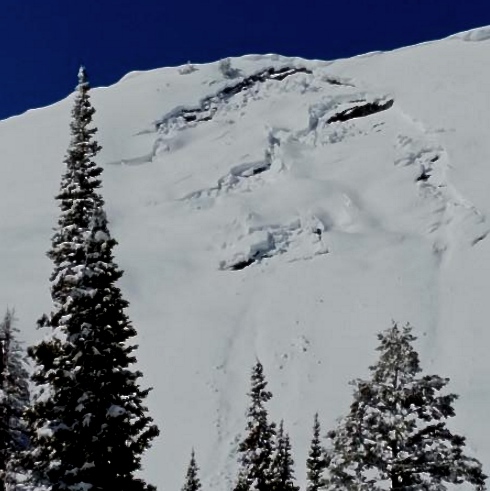
Jon Rosine sent in this picture of a glide avalanche on Wilderness Peak, north of the state line in Franklin Basin. 4/1/17
Additional Information
Fair weather is expected in the mountains today. High pressure aloft will move west to east across the Great Basin through Thursday. Following, a series of Pacific storm systems will begin Friday, and continue into early next week. Today will be mostly sunny, with a high temperature at 8500' of 42 °F and 8 to 10 mph west southwest wind. Tonight will be mostly cloudy, low temperature of 31 °F and 8 to 11 mph south-southwest wind. Thursday will have partly sunny skies, a high temperature of 52 °F and 8 to 17 mph south-southwest wind.
General Announcements
Discount lift tickets for Beaver Mountain, Snowbasin, Powder Mountain, and the Central Wasatch resorts are donated by the resorts to benefit the Utah Avalanche Center. Details and order information here.
Do you buy groceries at Smiths? When you register your Smith’s rewards card with their Community Rewards program, they will donate to the Utah Avalanche Center whenever you make a purchase. It's easy, only takes a minute, and doesn't cost you anything. Details here.
If you sign up for AmazonSmile and designate the Utah Avalanche Center as your favorite charity, they will donate a portion of everything you spend to the UAC. It doesn't cost you a penny and we'd really appreciate the help.
Your information can save lives. If you see anything we should know please help us out by submitting snow and avalanche observations. You can call us at 801-524-5304, email by clicking HERE, or include @utavy in your Instagram. In the Logan Area you can reach me at 435-757-7578
We will update this advisory regularly on Monday, Wednesday, Friday, and Saturday mornings by about 7:30.
This advisory is from the U.S.D.A. Forest Service, which is solely responsible for its content. This advisory describes general avalanche conditions and local variations always exist.