Planned Website Outage: The UAC website will be down for maintenance on June 17 from 2:00 - 7:00 PM MT.

Observation: Cardiff Fork

Observation Date
3/28/2017
Observer Name
Tyler Falk
Region
Salt Lake » Big Cottonwood Canyon » Cardiff Fork
Location Name or Route
Cardiff Fork
Weather
Sky
Overcast
Wind Direction
Northwest
Wind Speed
Light
Weather Comments
Sky cover switching between overcast and obscured through the day. High temps of 43 at the base of Alta this afternoon. 10,000 foot high temp in Cardiff was 25 degrees.
Snow Characteristics
New Snow Depth
13"
New Snow Density
Medium
Snow Surface Conditions
Powder
Damp
Snow Characteristics Comments

Height of new snow in the last 24 hours was around 34cm (13") with 1.08" of H2o. (Density 8.31%) Outside of sheltered upper elevation north aspects the new snow became damp from the warm temps, off and on sun and possible green housing from cloud cover at other times of the day. By late in the day the snow of south aspects changed from wet mank on the surface to a 2cm crust as the temperature dropped by my exit at 530. Some shallow 5cm thick wind slabs in exposed high north locations.

Red Flags
Red Flags
Heavy Snowfall
Rapid Warming
Red Flags Comments
A little more than a inch of mositure with warming temps were the main red flags today. Not a ton of dry snow avilable for transport tonight into tomorrow in most locations. 10k winds overnight might get into the low 20's but shouldent find a ton of snow to move except possibily in the high northerly locations an isolated wind slab might be found. Quick pit at 10k on north aspect showed good strength, strong structure and low energy. Graupel event from 3/22 not a huge concern but seamed farily widespread. It is buried 67cm down under a few recent stroms. Not very reactive in my ECTS but in areas where pooling occurs around cliffs it might be something to watch out for in isolated loacations. While not a persistant weak layer Graupel has been the weak layer identifyed in a few avalanche fatilities over the years. The first one that comes to mind is the Woulverine Cirque accident which killed Roman Latta in April of 1993. https://utahavalanchecenter.org/avalanches/21119
Avalanche Problem #1
Problem
Wet Snow
Problem #1 Comments

Tomorrow wet slabs would be my number one concern. High temps at 8500 look to be around 40. Old wet activity noticed in many of the lower canyon north and south facing chutes and also in the Hellgate apron.

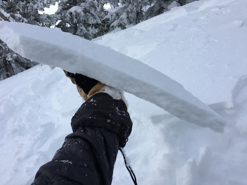
Pic 1. Shallow Wind Slab

Pic. 2. Sun Crust on South aspect late in the day.

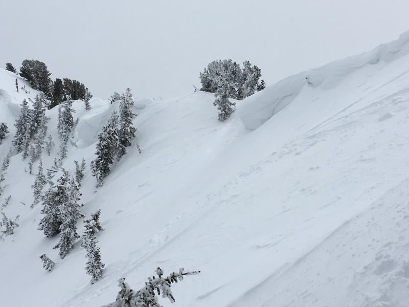
Pic. 3 Cornices still growing

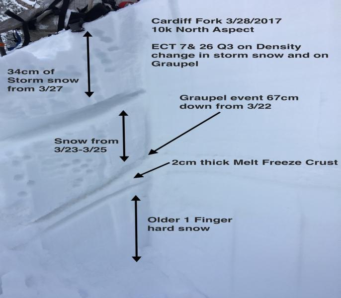
Pic. 4. Quick in Cardiff at 10k on a North aspect

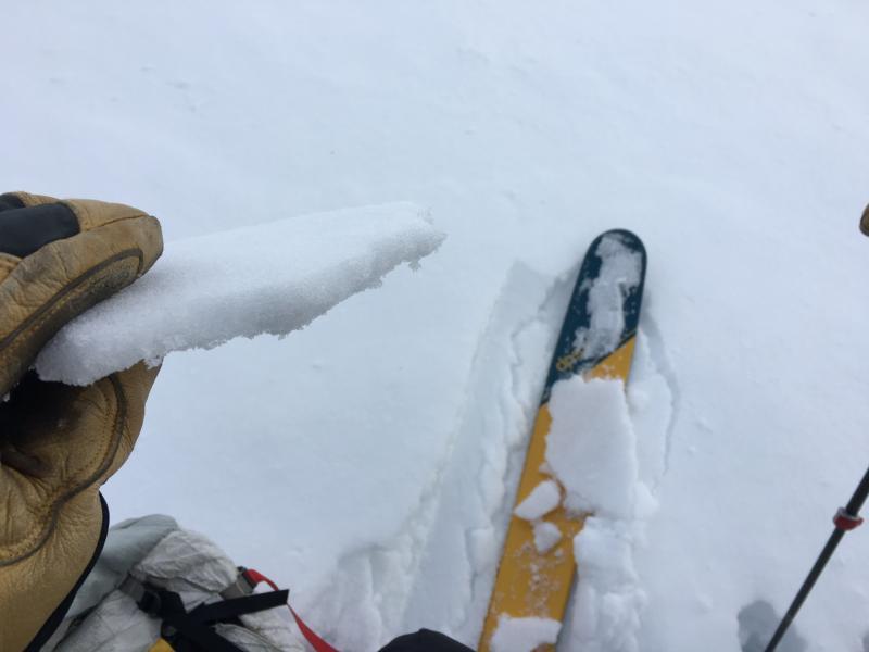
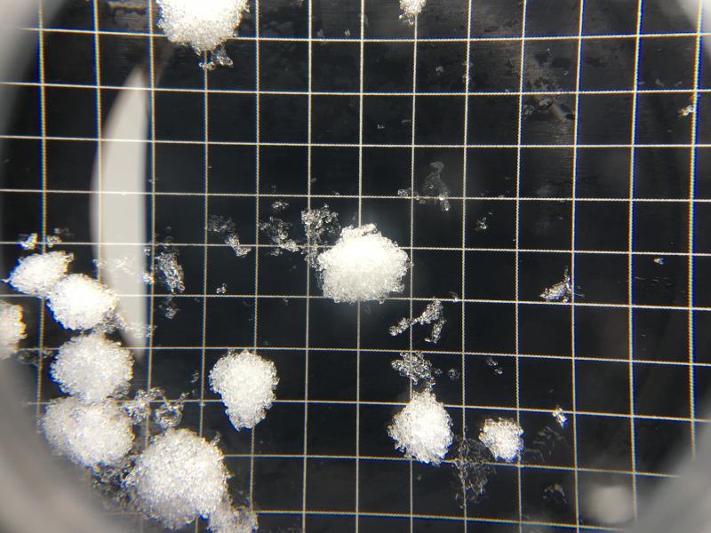
Pic. 5 Graupel from 3/22

Today's Observed Danger Rating
Moderate
Tomorrows Estimated Danger Rating
Moderate