Dawn patrol to enjoy the decent Saturday storm snow. Some dust-on-crust conditions, but the generally smooth crusted surface and dense snow from Saturday made for enjoyable riding and travel conditions.
I was able to get the Saturday storm snow to sluff on steeper north-facing terrain (i.e. Holy Moly), but it required slopes at least 40° in steepness, and not all slopes would sluff.
The storm snow from Wed/Thur has settled out and I was unable to get any clean shears between these two storm events. (On Thursday I was finding a poor bond at this interface, and it was still reactive on Friday as well.) The strong sun crusted all aspects on Friday (other than high due north) with crusts of varying thicknesses, and I am suspecting these crusts will provide a bed surface for any avalanche activity with the Monday/Tuesday storm.
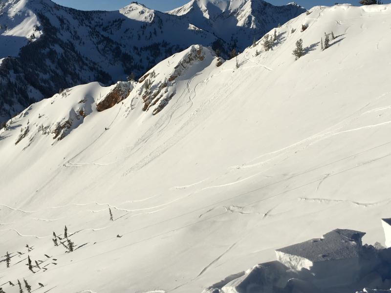
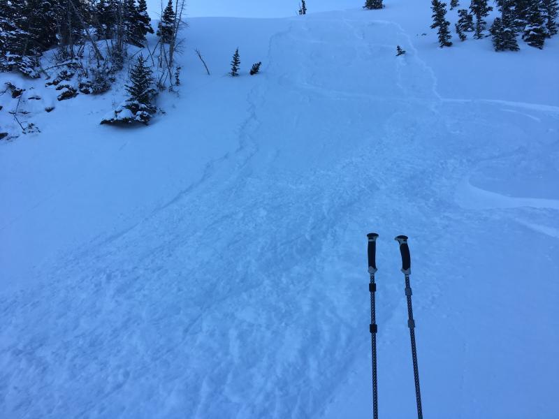
Photos are of loose, dry sluffs moving on the Friday sun crust. East and North aspects
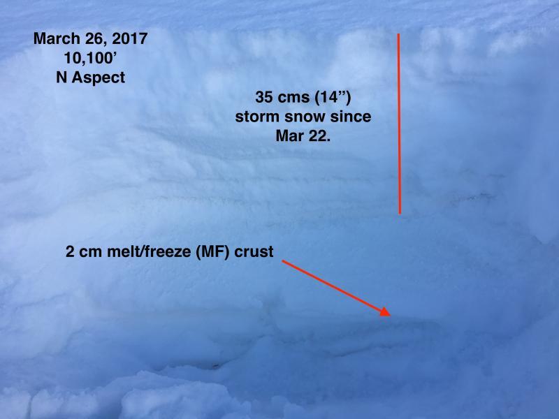
We got through the significant warm up in mid March without significant wet slabs likely because we had a mostly unstructured snowpack. I dug a few pits on upper elevation north aspects this morning, and noticed a M/F crust from the old (pre 3/22) snowpack. The thickness of this crust varies, and is now buried ~ 30 cms (12") down from the surface. When the north aspects inevitably warm up, it is worthwhile keeping this crust in mind as it may provide a barrier for liquid water to penetrate down through the snowpack. (Mark Staples' now-infamous "Tang Test")