

Forecast for the Uintas Area Mountains

Monday morning, March 20, 2017
With a sub-par refreeze, the avalanche danger quickly rises to MODERATE and human triggered avalanches are POSSIBLE. As the day heats up, you'll want to get off of and out from under on all steep, sun-exposed slopes. Once triggered, today's wet slides may fan out, entraining more snow than you might expect.
 Weather and Snow
Skies are clear, temperatures in the low to mid 30's, though a few hot spots (like Chalk Creek... below) report overnight lows in the 40's. Southwest winds have relaxed somewhat and are blowing 20-30 mph along the high ridges. Riding and turning conditions are a bit underwhelming and our snowpack has have taken a bit of a hit. In the past week we've lost about a foot of snow depth.
As far as the corn harvest is concerned... upper elevation sunny slopes are still a bit immature and slightly punchy and I think the shallow surface refreeze won't last too long on low and mid elevation south facing terrain. On the north half of the compass, it's hit or miss, though you'll still find patches of shallow, dense powder on wind sheltered, upper elevation slopes.
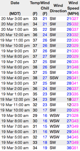
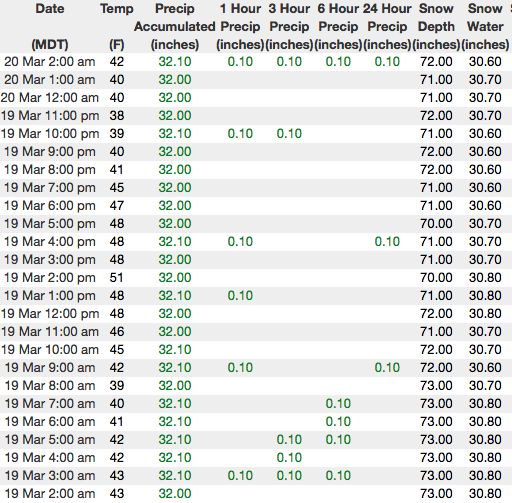
Above... 24 hour data from Windy Peak (10,600') and the Chalk Creek snotel site (8,993') reflecting a marginal overnight refreeze.
Real time wind, snow, and temperatures for the Uinta's are found here
Michael J was near Trial Lake and Mt. Watson over the weekend. He found a mostly stable snowpack and excellent riding conditions on upper elevation slopes. More on his trip report found here.
Snowpack observations and trip reports are found here.
 Recent Avalanches
No new avalanche activity from yesterday.
A full list of Uinta avalanche activity is found here.

Wet Snow
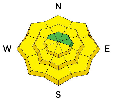
Description
Today's wet avalanche activity larely depends on the balance of sun, cloud cover, and wind. Remember- this is the time of year when you wanna think about your end of the day exit strategy. As the snow turns damp, manky, or unsupportable you'll need to get off of and out from under steep, sunny slopes and avoid terrain traps like gullies and road cuts where tree snapping, cement-like debris can stack up very deeply.
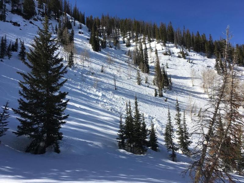
More the rule than the execption... Dan found this wet avalanche Friday on an east facing slope near the Mirror Lake Highway at appoximately 10,000'.
Cornice
Description
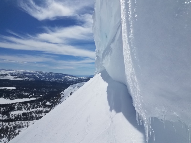
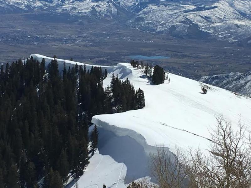
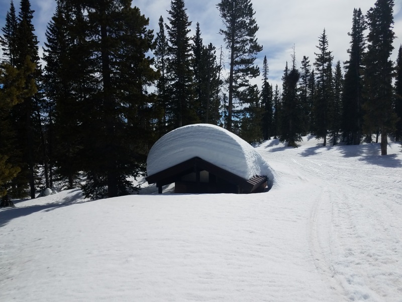
This years corni are beautiful and they come in all shapes and sizes, some are larger than others. In either case, these unpredictable pieces of snow are releasing on their own accord and breaking further back than you might expect. Of course, you don't want to be on the receiving end of one of these boxcar-like monsters.
Additional Information
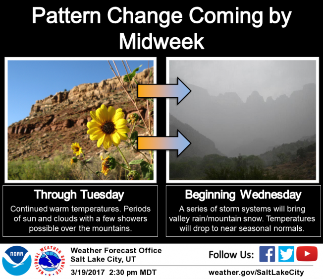
Expect partly cloudy skies with highs reaching into the 50's. Southwest winds are gonna be a nuisance, blowing in the 30's and 40's with gusts to 60 mph. along the high ridges. A passing disturbance brings a chance of a shower or thunderstorm this afternoon and evening. A cold front is expected Tuesday night, followed by a broad cold and wet storm Wednesday and Thursday. So we're back in the game by late in the week!
General Announcements
Remember your information can save lives. If you see anything we should know about, please participate in the creation of our own community avalanche advisory by submitting snow and avalanche conditions. You can call me directly at 801-231-2170, email [email protected]
The information in this advisory is from the US Forest Service which is solely responsible for its content. This advisory describes general avalanche conditions and local variations always occur.
The information in this advisory expires 24 hours after the date and time posted, but will be updated by 7:00 AM on Tuesday March 21st.