Overnight temperatures dropped into the low 20s and southerly wind is light to moderate in speed but is hinting at increasing in speed. Very warm temperatures on Friday heated the snow surface on all but the higher more northerly facing slopes. Check out Darce Trotter and Steve Cote's backcountry observations from Friday HERE.
WEEK IN REVIEW: Weather, Snow and Avalanches.
The week started off with an intense cold snow storm that laid down 15 inches of new snow on Monday. The snow was falling very rapidly toward the end of the storm with snowfall rates up to 3 inches an hour. This caused some instabilities within the new snow which was evident in areas where you could see that the slope had "spiderwebbed" with cracks. This was a shallow instability near the surface and didn't produce large avalanches. However, the wind did increase on Tuesday and drifted the new snow creating large drifts, cornices and fresh wind slabs. Consequently, the wind drifted enough snow to overload some slopes and make them avalanche.
| Date |
Region |
Place |
Trigger |
Depth |
Width |
Aspect |
Elevation |
Weakness |
|
| 02/28/2017 |
Skyline |
Bulger Canyon |
Natural |
|
|
Northeast |
11000 |
Density Change |
Details |
| 02/28/2017 |
Skyline |
Potters |
Natural |
|
|
Northeast |
10600 |
Density Change |
Details |
As the week progressed, these drifts and wind slabs became more stable and harder to trigger. Most people found excellent deep powder riding conditions all week. Temperatures gradually warmed through the end of the week making the snow surface damp on many aspects and all lower elevations.
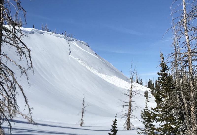
Snowmobilers triggered a few avalanches along the upper ridgelines when they were riding out of Ephraim Canyon on Friday. These were very steep slopes where the wind had deposited snow earlier in the week. Solar heating may have also played a role in loosening the wind slabs making them more sensitive and easier to trigger.