Planned Website Outage: The UAC website will be down for maintenance on June 17 from 2:00 - 7:00 PM MT.

Observation: Tanners Gulch

Observation Date
2/26/2017
Observer Name
Tyler Falk
Region
Salt Lake » Little Cottonwood Canyon » Tanners Gulch
Location Name or Route
Tanners
Weather
Sky
Clear
Wind Direction
West
Wind Speed
Light
Weather Comments
Travel today was limited to south aspects from 7300' to 10700'. Clear skys with temps around 20 in the mid canyon area of LCC early. Moderate winds encouraged turbulent suspension high on Sunrise and Dromadary peak and other 11k ridgelines at sunrise but seamed to settle down after 8 am. High temps in the mid canyon today at 7k were 30 degrees and at Alta reached 25 at the base.
Snow Characteristics
New Snow Depth
1"
New Snow Density
Low
Snow Surface Conditions
Powder
Snow Characteristics Comments

The storm snow has settled a fair bit and ski penetration is around 48cm which made travel easier. In channeled terrain the wind damaged some of the new snow. Some hollow wind loaded pockets noticed above 10k on Southeast aspects. Most places the storm snow has bonded well and sluffing in the new snow did not run as far.

Red Flags
Red Flags
Wind Loading
Red Flags Comments
Although not recent since they were likely triggered Friday a number of what looked to be artilerly triggered avalanches were vissable going up Tanners this morning. These were limited to southeast aspects at 10k. I would call them SS-AS-C-R2-D2. Crown height appered to be two to three feet high and some a few hundred feet wide. Looked like wind loaded pockets by the size and direction of cornices on the ridgeline.
Avalanche Problem #1
Problem
Wind Drifted Snow
Problem #1 Comments

Going with windslabs again for number one threat out there tomorrow. As this next storm pushes in we should see some pre frontal winds and transport of new snow. Cottonwoods forecast is calling for gusts on 11k ridgelines to be 60mph and 9k ridgelines with 30 mph gusts. Some of the highest wind gusts at the 10 o'clock hour while writing this are...

Arrowhead Summit - 41 mph

Bunnells Ridge - 38 mph

Alta Mt. Baldy LCC- 59 mph

S Curves BCC- 33 mph

Reynolds Peak BCC- 35 mph

Empire Peak - 50 mph

Snowbasin Strawberry- 57 mph

Most stations blowing from S or SSW.

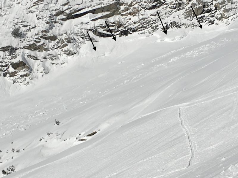
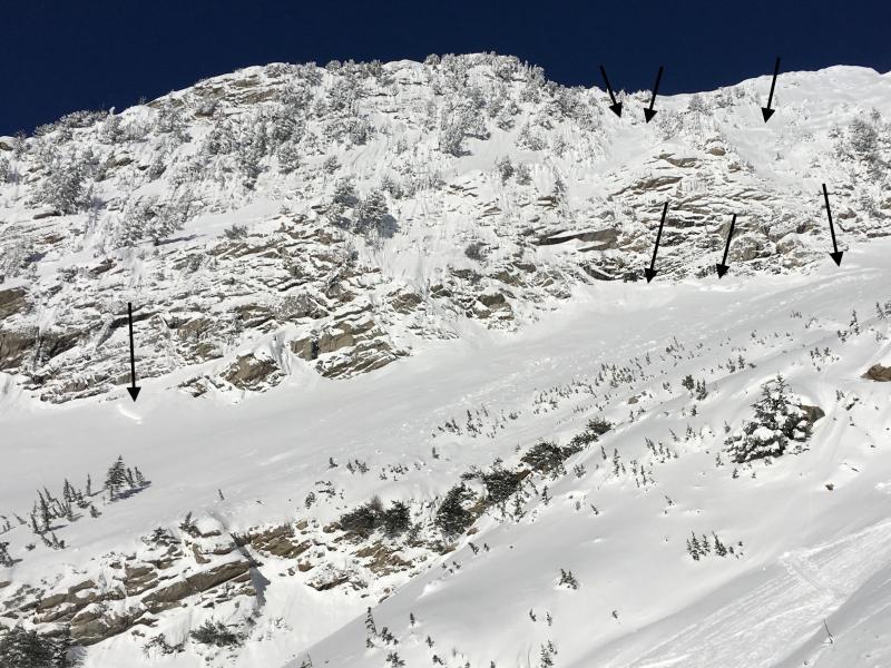
Pictures. 1-3 Likely artillery triggered avalanches on SE aspects at 10k

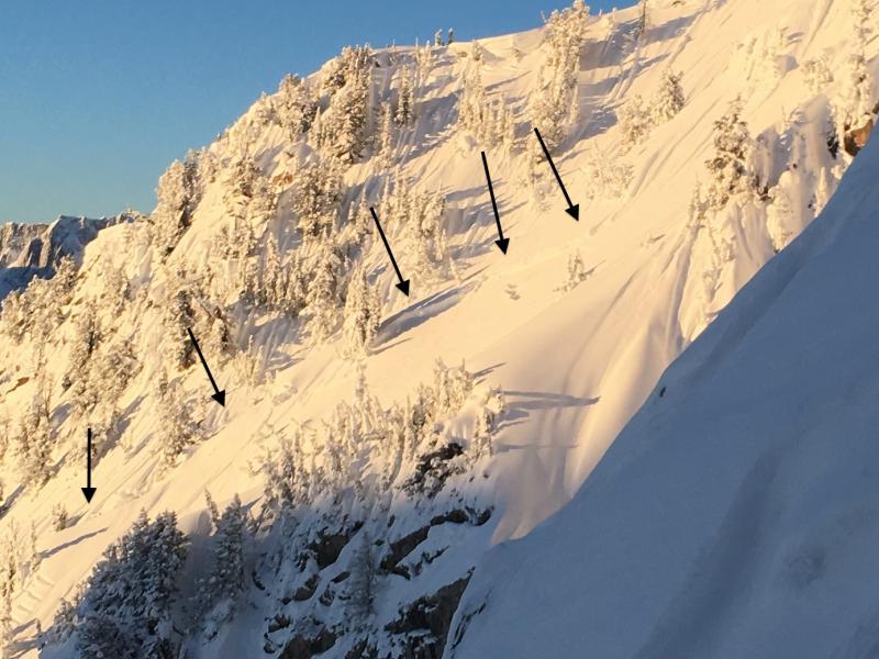
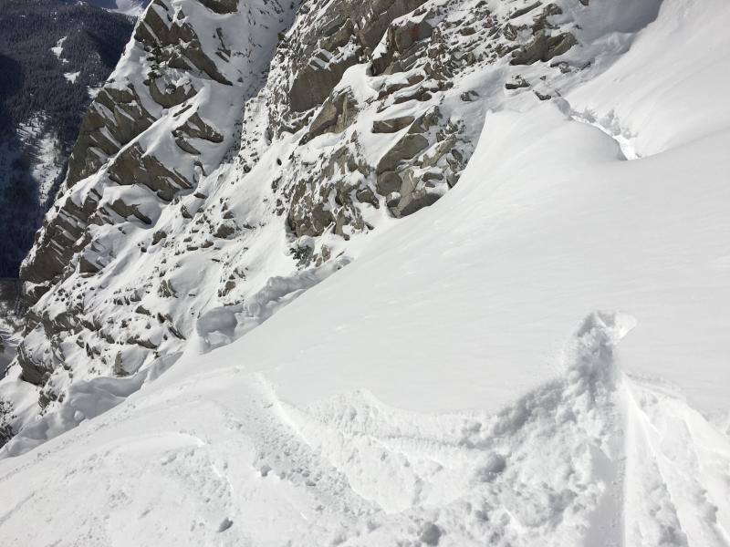
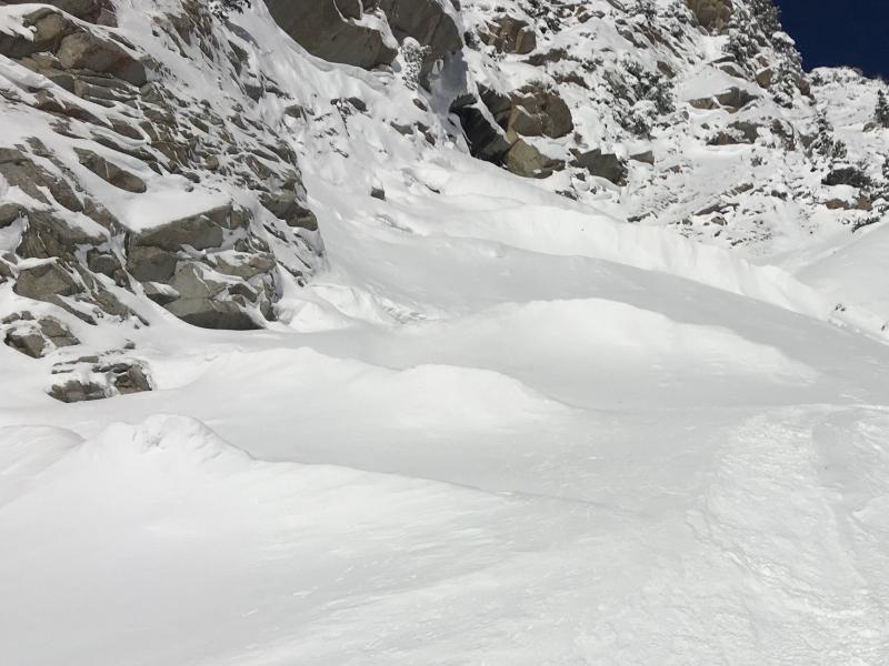
​Pictures 4&5- Several Moats in Tanners pictured are down lower in the apron. Also noticed in the upper chute. I have noticed more of these this year around the Wasatch than normal.

Today's Observed Danger Rating
Moderate
Tomorrows Estimated Danger Rating
Moderate