Forecast for the Skyline Area Mountains

Brett Kobernik
Issued by Brett Kobernik for
Sunday, February 26, 2017

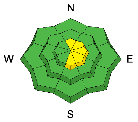
The majority of the terrain has a LOW avalanche danger. There is still a MODERATE avalanche danger along the higher very steep recently wind loaded slopes which are generally facing easterly. We may see fresh wind drifts and slabs forming later today as the southerly wind increases. Wind drifts and slabs are the most sensitive when they are forming.
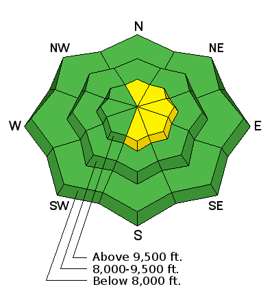
Low
Moderate
Considerable
High
Extreme
Learn how to read the forecast here
Weather and Snow

The Manti Skyline region picked up another 3 to 4 inches of snow on Saturday. The wind was well behaved for the most part but there was some drifting going on along the 10,000' ridges. The newer snow is "right side up" and there are no notable weak layers. During our travel on Saturday, my partner and I did note some minor cracking of freshly drifted snow along the east facing sides of the higher ridges. We were on slopes of only about 30˚ in steepness. I'm guessing that a person could have gotten some small slabs to crack out on steeper slopes.

Mountain low temperatures overnight were again down into the single digits. West wind is light to moderate in speed. Riding conditions are as good as it gets.

Ad
Avalanche Problem #1
Wind Drifted Snow
Type
Location
Likelihood
Size
Description

As time goes on, the recently formed wind drifts and slabs will become more stubborn. However, today we'll actually be able to see along the higher terrain and probably more people will get into the terrain where these drifts my still be sensitive. The most likely place to trigger an avalanche today is the very steep more easterly facing slopes above 9500 feet in elevation. Keep in mind that the wind will start to increase later today and will move the low density powder creating fresh drifts.

Additional Information

We'll see mostly clear skies today with ridge top temperatures in the mid 20s. Southerly wind will be light to start and will gradually increase as the day goes on. Another storm is on tap for Monday which could bring 5 to 9 inches of new snow by Tuesday.

General Announcements

We will publish full detailed advisories Saturday and Sunday mornings by 7am. We will also be publishing basic avalanche danger ratings & info during the week.

If you are getting out into the mountains, we love to hear from you! You can SUBMIT OBSERVATIONS ONLINE or EMAIL US

If you would like to have avalanche advisories emailed to you, SIGN UP HERE

We can provide basic avalanche awareness presentations for your school, group or club. To enquire, CLICK HERE