UDOT PLANNED AVALANCHE CLOSURES!!

Observation: Maple Hollow

Observation Date
2/25/2017
Observer Name
Toddeo
Region
Southwest » Pahvant Range » Maple Hollow
Location Name or Route
Pahvants - Maple Hollow
Weather
Sky
Overcast
Wind Speed
Calm
Weather Comments
Cloudy day with a bit of sun. not enough to dampen snow on low elevation northerly aspects.
Snow Characteristics
New Snow Depth
10"
New Snow Density
Medium
Snow Surface Conditions
Powder
Snow Characteristics Comments

HST = 10' at 7,400'. Snow is sitting on top of a supportable snow surface.

Red Flags
Red Flags Comments
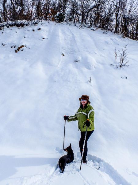
With the exception of sluffing during the storm on steep aspects (see photo below), no red flags were observed, however I only got to 7,400' or so.
Avalanche Problem #1
Problem
New Snow
Trend
Same
Problem #1 Comments

Based on some quick shear tests, the primary hazard would be storm slab. I was able to shear the new snow at or just above the crust in a layer of 1-3 mm graupel. Shears were in the moderate range and Q2/3. It appears the snow came in dry with graupel and did not bond all that well.

Avalanche Problem #2
Problem
Normal Caution
Trend
Same
Problem #2 Comments

Normal caution, It looks like there might have been some new cornice development at higher elevations, I should know more tomorrow.....

Snow Profile
Aspect
North
Elevation
7,000'
Slope Angle
35°
Comments

HST = 10". Crust surface is visible.

Photo below, sluffing at 6,800'.

A short tour to get some of tomorrow's trail breaking done in advance.

Still partial access with additional walking until some of the low elevation snow melts.

Overall I would speculate a moderate hazard consistent with the Skyline forecast but would be concerned about the storm slab sliding above the crust.

Today's Observed Danger Rating
Moderate
Tomorrows Estimated Danger Rating
Moderate