Planned Website Outage: The UAC website will be down for maintenance on June 17 from 2:00 - 7:00 PM MT.

Observation: North Ogden Divide

Observation Date
2/24/2017
Observer Name
kory
Region
Ogden » North Ogden Canyon » North Ogden Divide
Location Name or Route
North Ogden Divide
Weather
Sky
Few
Weather Comments
Just clear and calm for a quick dusk patrol lap.
Snow Characteristics
New Snow Depth
18"
New Snow Density
Medium
Snow Surface Conditions
Powder
Snow Characteristics Comments

Classic.

Red Flags
Red Flags
Heavy Snowfall
Red Flags Comments
It really did fall straight out of the sky today and last night.
Avalanche Problem #1
Problem
New Snow
Trend
Same
Problem #1 Comments

This was really the only thing we could get to move today especially with the high precip rates and steep slopes. Over 35. I am keeping this at same just for tomorow morning than I think it will decrease. We have clear skies here in the Ogden Valley so the snow will stay low density and probably dry out over night.

Avalanche Problem #2
Problem
Normal Caution
Trend
Decreasing Danger
Problem #2 Comments

I don't know what to put for the second problem. We really couldn't do much with storm or wind slabs today. But those would be my second choices.

Comments

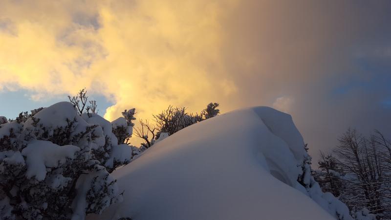
Just classic. Pretty decent precip rates all day S-1 to S-2 at times. I was very surprised expected it to taper of sooner. I ski cut everything on the divide up to 40 degrees and tried to pop out little wind waves and they just had no slab to them. Makes for excellent skiing. I was really worried about fast deep loose dry snow avalanches in steep consequential terrain today but we made it thought the day! Jumped on some smaller cornice today also. Not much happened. Really I cant find a great storm total all of our weather stations seem to be on the fritz (maybe to much snow). But I would put it in the 30-40" range at 8000 ft.

I am already starting to think about the snow surface. It looks like we are going to go into a couple of cold clear nights here in the Ogden Valley. That means NSF (near surface facets will be forming) current models are showing 1ft pluss from sunday into tuesday. This could create touchy wind and storm slabs. Time to start tracking the current snow surface again!

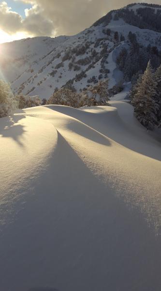
Skied Snowbasin and its backcountry in the AM. Was surprised with how much snow still fell today. Great right side up riding. Not much today. This video was about the most of a slab I could find! Sorry really bad video.

Video
Today's Observed Danger Rating
Moderate
Tomorrows Estimated Danger Rating
Moderate