Planned Website Outage: The UAC website will be down for maintenance on June 17 from 2:00 - 7:00 PM MT.

Observation: Days Draw

Observation Date
2/22/2017
Observer Name
Dunn
Region
Salt Lake » Big Cottonwood Canyon » Days Fork » Days Draw
Location Name or Route
Days Draw
Weather
Sky
Obscured
Precipitation
Light Snowfall
Weather Comments
After an overnight snowfall of approximately 12" in Days Draw, the clouds moved in and it began snowing again by mid-morning and continued to snow lightly through the rest of the day. There was very little wind. About 1" of snow fell during the day.
Snow Characteristics
New Snow Depth
12"
New Snow Density
Low
Snow Surface Conditions
Powder
Snow Characteristics Comments

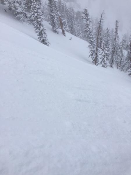
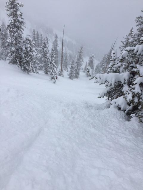
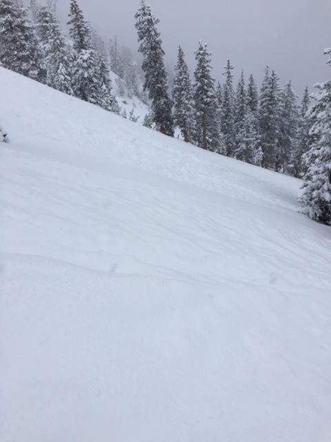
Tuesday night's snow deposited about 12" of right side up snow on top of a variety of surfaces in Days Fork. The top 8-10" of snow was very low density and provided great skiing conditions. Above about 9k the underlying surface was dense but soft snow from the Saturday/Sunday storm. Below about 8.5k the underlying surface seemed to be a rain crust as it was present on all aspects.

Red Flags
Red Flags
Recent Avalanches
Red Flags Comments
Todays problem was sluffing. There were some fairly large natural sluffs that ran for a couple hundred vertical feet that came off the steeper terrain on far skiers left of Days Draw. Some of them were definitely large enough to knock you down. We also triggered some large and long running sluffs when we skied the steeper terrain just down off the top of Days Draw, with some of these skier triggered sluffs running a couple hundred vertical. The sluffs seemed to involve only the new 12" of snow and did not seem to step down into the older snow. Other than sluffs, we saw no signs of instability. Pictures try to show the size of the sluffs, but you get the idea. Today's conditions seemed manageable, so I went with Moderate hazard, but if it snows much more, tomorrow's hazard will increase.
Today's Observed Danger Rating
Moderate
Tomorrows Estimated Danger Rating
Moderate