Planned Website Outage: The UAC website will be down for maintenance on June 17 from 2:00 - 7:00 PM MT.

Observation: Cardiff Pass

Observation Date
2/12/2017
Observer Name
Tyler Falk
Region
Salt Lake » Little Cottonwood Canyon » Cardiff Pass
Location Name or Route
Cardiff Pass
Weather
Sky
Clear
Wind Direction
East
Wind Speed
Light
Weather Comments
First day in a stretch high pressure which looks like it will last till Friday. Temps have dropped significantly since Thursday. Difference of 47 degrees between high temp Thursday (70) and the valley low this morning at 23. Four foot tall boulders along side the shoulder of the road were indictors of heavy rain in the lower canyon. Teens in upper LCC this morning which rose to the mid 40's this afternoon at the base of Alta. East winds on 10k ridgelines were light this morning transporting minor amounts of the new light density snow.
Snow Characteristics
Snow Surface Conditions
Powder
Dense Loose
Snow Characteristics Comments

The cold temps last night might have helped the storm snow dry out a bit but like Greg said in his observation yesterday it insulated the wet snow underneath preventing it from cooling. I saw wet grains 9500' and below today on south aspects. For upper LCC, storm totals were around 17" of snow with 2.16" of water which started out around 14% and dried out to make right side up riding conditions. Some minor wind loading on west and northwest aspects above 10k from the east winds. There were also a few crossloaded pockets on east and southeast. Loose snow slufs on all aspects. Winds were blowing in the low teens this morning and seemed to die off later in the day. I would imagine most sunny aspects below 10k will have a crust on them come morning.

Red Flags
Red Flags
Recent Avalanches
Cracking
Rapid Warming
Red Flags Comments
Recent avalanches on southeast aspects in the typical locations. A few artilerly triggered slides from yestarday morning were vissable along with a possible skier triggered soft slab near toledo chute. Artilerly results on LSB, Superior and Monte Cristo. Loose wet snow in many of the lower canyon chutes. Some cracking in shallow windslabs on upper elevation east aspects.
Avalanche Problem #1
Problem
New Snow
Trend
Decreasing Danger
Problem #1 Comments

Storm slabs could be the largest threat tomorrow in isolated areas where the new snow has bonded poorly. In most terrain I feel they have settled out.

Avalanche Problem #2
Problem
Wet Snow
Trend
Decreasing Danger
Problem #2 Comments

Wet activity and wind slabs are the other two concerns for tomorrow. Upper elevations should get into the high 30's tomorrow. While winds have backed off some lingering wind slabs might still be reactive up high.

Comments

There have been twenty-one storms at Alta with 6" or more snow this year. Average density 10%. More than 300cm of snow above 9800'. I have counted four different rain events in Park City this year. Most instabilities this year have been direct action within new snow. Mild temperatures overall this season. The Karl Birkeland and Cary Mock paper on Snow Climatology from 2000 shows that if Alta does not get a Intermountain season they are more than 3 times more likely to get a Costal or Maritime season over a Continental season.

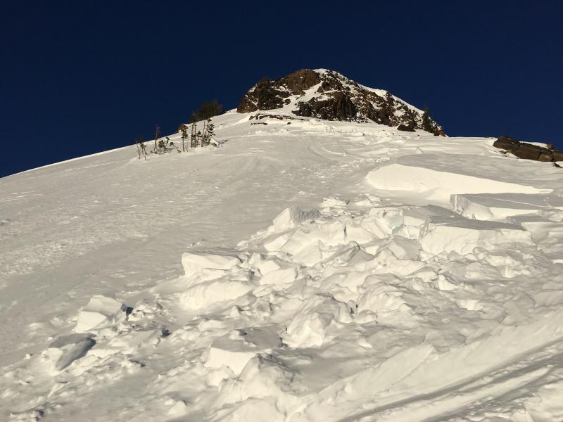
Pic 1. Slide on the Little Superior Buttress SS-AA-C-R2-D2

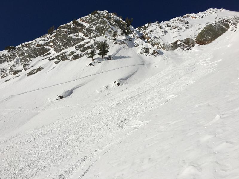
Pic 2 & 3. Superior SE 10k. SS-AA-C-R2-D​2

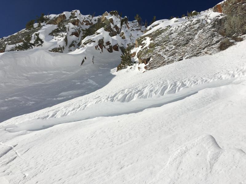
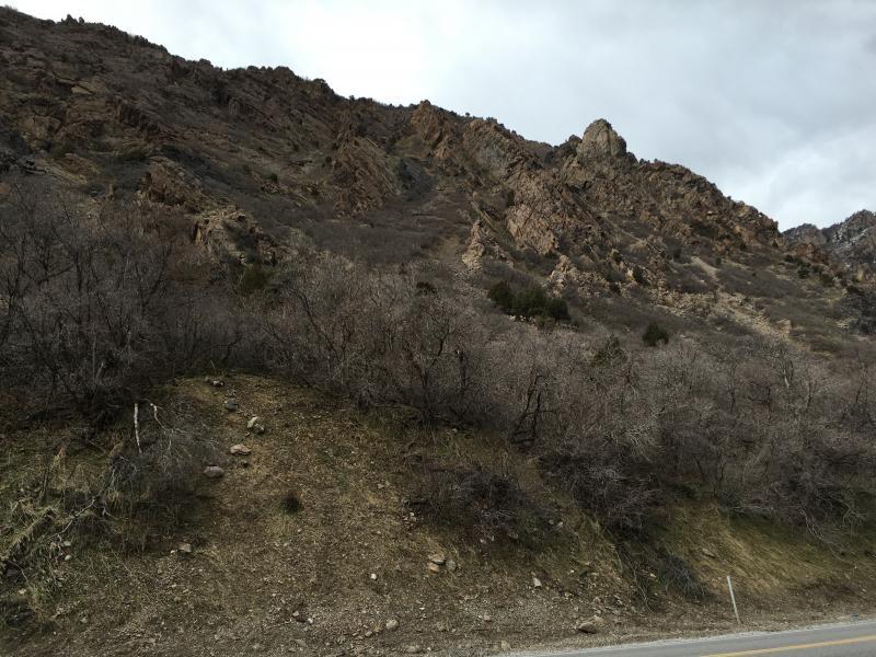
Pic 4. Shallow windslab upper elevation southeast

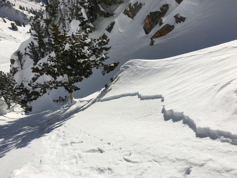
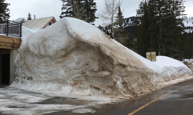
Pic 5 & 6. Showing what a Maritime snowpack looks like at bottom and top of BCC on Thursday.

A few current snowpack numbers...

Northern Wasatch

Lightning Ridge (8215') - 214%

Ben Lomond Peak (8000')-181%

Central Wasatch

Brighton (8750')- 168%

Snowbird (9144')-179%

Southern Wasatch

Timpagnoas Divide (8140')- 203%

Cascade (7774')-127%

Unitas

Trial Lake (9992')- 214%

Hayden Fk. (9212') -177%

Smith Morehouse (7600')- 134%

Bevar Divide (8280') -217%

Daniels Strawberry (8037') -233%

Mock, Cary J., and Karl W. Birkeland. "Snow Avalanche Climatology of the Western United States Mountain Ranges."Bulletin of the American Meteorological Society81.10 (Oct. 2000): 2367-392. Web.

Today's Observed Danger Rating
Moderate
Tomorrows Estimated Danger Rating
Moderate