


Forecast for the Skyline Area Mountains

Sunday morning, February 12, 2017
The majority of the terrain has a LOW avalanche danger. Continue to use caution along the higher east facing steep slopes where recent wind has drifted snow into cornices and wind slabs. Move off of steep slopes and out of steep gullies if you notice the snow becoming really wet.
 Special Announcements
Huntington Canyon remains closed because of avalanche debris still covering the road. Avalanche conditions were too dangerous for crews to clear the debris on Friday. The road will most likely re-open on Monday.
 Weather and Snow
The dense new snow from Friday night did not seem overly sensitive on Saturday. It provided quite nice riding conditions even though it was heavier snow on top of some fairly damp snow from the warm temperatures earlier in the week. Wind was light to moderate during the day on Saturday. It remained light overnight from the northeast. Overnight temperatures dipped into the upper teens along the higher terrain. Most weather stations are in the low to mid 20s now.
 Recent Avalanches
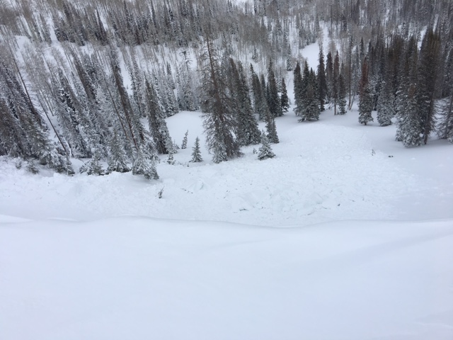
There were some cornices that had formed and broken off naturally during the windy storm. Some of these triggered some minor soft slab avalanches below. On Saturday by the time I was looking at the slopes under the fresh cornices, things seemed stubborn to me and unlikely that a person would trigger anything unless they were on top of a cornice and it broke off.
Photo below: Natural cornice fall off the Trough Springs Road near the Skyline Mine. Drew Hardesty.

Normal Caution
Description
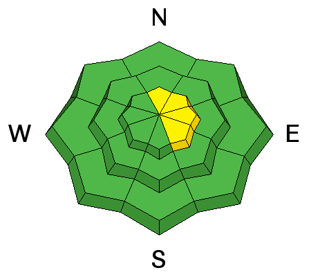
Colder temperatures have halted any wet avalanche activity. The new snow is mostly stable. There are no significant burried weak layers within the snowpack. Places you might trigger something, although I feel it's unlikely, would be along the upper ridges where cornices and fresh drifts have formed during the recent storm.
Wet Snow
Description
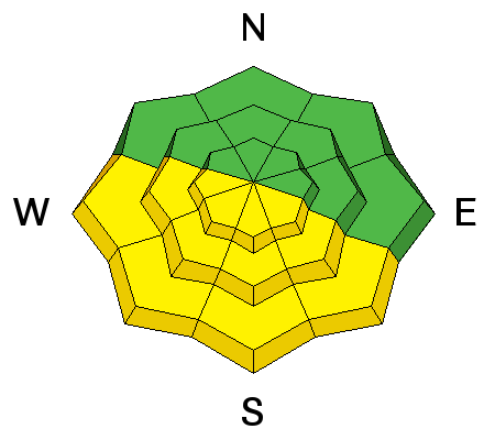
Direct sun may loosen up the new snow enough to produce some loose wet avalanches later today on the more southerly facing slopes. Watch for pinwheeling or "rollerballing" which indicates that the snow is becoming damp.
Additional Information
Today we'll have a few high clouds, light east wind and high temperatures along the ridges in the low to mid 30s. High pressure moves in today and will remain in place through the work week. We'll see plenty of sun and gradually warming temperatures during the week. The next storm system on the horizon looks like Friday into Saturday but details are vague at this time.
General Announcements
We will publish full detailed advisories Saturday and Sunday mornings by 7am. We will also be publishing basic avalanche danger ratings & info during the week.
If you are getting out into the mountains, we love to hear from you! You can SUBMIT OBSERVATIONS ONLINE or EMAIL US
If you would like to have avalanche advisories emailed to you, SIGN UP HERE
We can provide basic avalanche awareness presentations for your school, group or club. To enquire, CLICK HERE