Forecast for the Skyline Area Mountains

Saturday morning, February 11, 2017
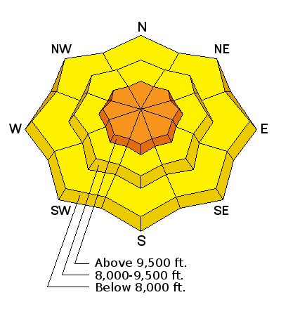
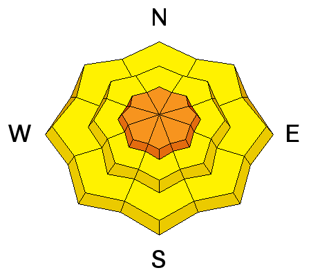
The avalanche danger is CONSIDERABLE along the higher terrain where wind has been drifting snow. Use small steep test slopes to get a feel on how sensitive the new drifts are. Avoid cornices and obvious pillows of fresh wind blown snow on larger steep slopes.

 Special Announcements
Huntington Canyon remains closed because of avalanche debris still covering the road. Avalanche conditions were too dangerous for crews to clear the debris on Friday. The road will most likely re-open on Monday.
 Weather and Snow
Precipitation started on Friday afternoon with the rain/snow level at around 8500'. About 5 inches of high density snow has accumulated most pronounced on the more northern Skyline. Temperatures have cooled to around freezing at most mountain weather stations. Wind has been strong along the ridges from the west southwest.
Wind Drifted Snow

Description
It is hard to say if the wind drifted snow will be sensitive to people today. My gut tells me that things won't be all that sensitive but we need to approach the mountains with caution and expect human triggered avalanches within the new snow until we see that the new snow is stable. There are no persistent weak layers buried within the snowpack so we are only concerned about the newest layer of snow.
Additional Information
The storm will gradually wind down today. We may see a little more snowfall this morning with a trace to a couple of inches accumulation. Southwest wind will slow during the day. We'll see mostly cloudy skies perhaps with some clearing later this afternoon. Ridgetop temperatures will cool into the mid 20s. Sunday looks like a nice day with mostly clear skies, temperatures in the low 30s. High pressure with mild weather and a warming trend sets up for most of the work week with the next storm hinted at in the models late in the week.
General Announcements
We will publish full detailed advisories Saturday and Sunday mornings by 7am. We will also be publishing basic avalanche danger ratings & info during the week.
If you are getting out into the mountains, we love to hear from you! You can SUBMIT OBSERVATIONS ONLINE or EMAIL US
If you would like to have avalanche advisories emailed to you, SIGN UP HERE
We can provide basic avalanche awareness presentations for your school, group or club. To enquire, CLICK HERE


