Observation: Reynolds Pk

Observation Date
2/6/2017
Observer Name
Evelyn
Region
Salt Lake » Big Cottonwood Canyon » Reynolds Pk
Location Name or Route
Reynolds
Weather
Sky
Overcast
Precipitation
Light Snowfall
Wind Direction
South
Wind Speed
Moderate
Weather Comments
Just a few snow squalls, with small grauple falling in the afternoon. The rain/snow line was around the S Curve in BCC (6200'). Winds moderate, with strong gusts, but only near the top of the peak. Elsewhere, calm and warm.
Snow Characteristics
New Snow Depth
1"
New Snow Density
Medium
Snow Surface Conditions
Dense Loose
Wind Crust
Melt-Freeze Crust
Damp
Snow Characteristics Comments

Only about an inch of new snow, but on northerly facing slopes it's on top of 4" to 8" of soft powder, so makes for good turning. Elsewhere, widespread breakable crusts where it's cool, damp snow below about 7,000' or 7,500'. A general feeling of dampness, warmth and settling snow at this mid to low elevation.

Red Flags
Red Flags
Wind Loading
Comments

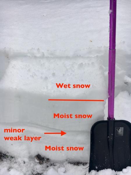
Took a quick look at a lower elevation slope, north facing, 6,200 feet. Snow pack is isothermic, and moist throughout, with the surface wet, soggy snow. Thinking of the rain that is forecast, I would expect mostly wet loose sluffs at the lower elevations. The "mid pack weak layer" was not very reactive, no failure on an ECT.

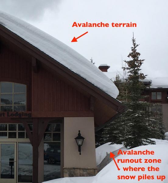
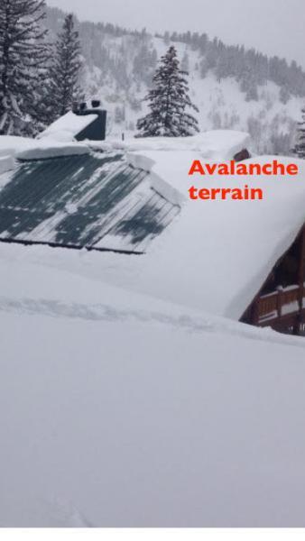
The upcoming storm will add rain and/or wet snow to the snow pack on the roofs of houses and cabins, a classic recipe for avalanches off roofs.

Photo #2 courtesy of Bruce Engelhard.

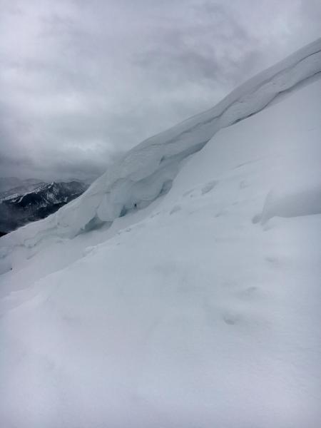
The strong winds were confined to just the upper part of the peak, dead calm elsewhere. But definately finding plenty of snow to move....and new cornices were sensitive. Also worth noting, in many places the new cornices are sitting on all the huge old cornices that built up last month. And depending on how you approach an "edge", you may be way out on a huge old cornice, not just dealing with a small new cornice.

Today's Observed Danger Rating
Considerable
Tomorrows Estimated Danger Rating
High