Join us at our 2nd Annual Blizzard Ball

Observation: Cutler Ridge

Observation Date
2/4/2017
Observer Name
Mike H and Derek D
Region
Ogden » Ben Lomond » Cutler Ridge
Location Name or Route
Cutler Ridge
Weather
Sky
Broken
Wind Direction
Southwest
Wind Speed
Moderate
Weather Comments
Somewhat dreary day on Cutler Ridge. Spitting rain at the trailhead for a minute, but nothing significant. The winds were moving lots of snow on the ridge tops, and above the Ben Lomond Peak weather station. Temps were warm but as forecasted the temps dropped throughout the day, which began to create some melt freeze crusts in lower elevations.
Snow Characteristics
New Snow Depth
5"
New Snow Density
Medium
Snow Surface Conditions
Powder
Dense Loose
Melt-Freeze Crust
Damp
Snow Characteristics Comments

We checked a lot of boxes in conditions today. When I began my day, I was prepared for lots of wind crust, and breakable crusts. Most all of the mid elevation northern aspects skied very well. So long as you stepped off the skin track and went searching, good snow was not hard to find. Melt freeze crusts in our lower elevations formed in the afternoon as the temps cooled and the sun disappeared. We didn't venture into the upper elevations today with all the wind.

Red Flags
Red Flags
Wind Loading
Red Flags Comments
Lots of snow moving around the ogden mountains today. Easily visable on sub ridges, the skyline ridge, and even over towards avon pass. If these winds increase we will see the touchiness and sensitivity increase as well. It appeared as though there was a small reminence of preserved surface hoar from the past week of high pressure. I was surprised to find it still present, but I think that is going to be a non issue even with more snow. The SH was extremely small and very deteriorated but was able to be triggered in CTs.
Avalanche Problem #1
Problem
Wind Drifted Snow
Trend
Increasing Danger
Problem #1 Comments

Lots of snow available for transport and lots of wind out there today. I imagine we will see some larger wind slabs forming off our ridges and sub ridges.

Avalanche Problem #2
Problem
Persistent Weak Layer
Trend
Decreasing Danger
Problem #2 Comments

We still have some layers of concern but this problem is becoming harder and harder to find. If we do trigger one of these avalanches though, it could be catastrophic and in the right terrain, unsurvivable. Low probability, High consequence is the name of the game with these. No results with our ECT tests today despite the compression tests revealing some instabilities.

Comments

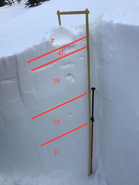
Picture 1 - Snow profile (note the 300cm probe next to the ruler.... its deep out there)

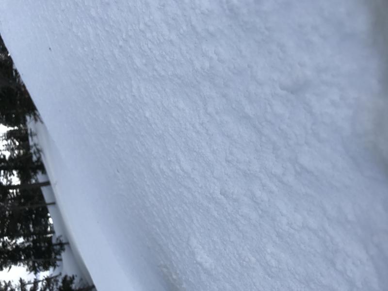
Picture 2 - some graupel on the surface (above 7,000 ft)

Video
Today's Observed Danger Rating
Moderate
Tomorrows Estimated Danger Rating
Moderate