Forecast for the Skyline Area Mountains

Saturday morning, February 4, 2017
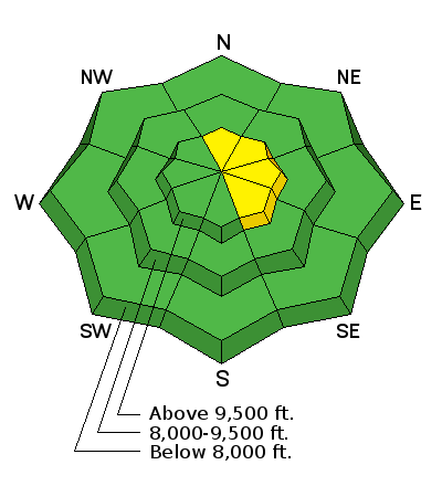
The avalanche danger remains generally LOW in the majority of the terrain. There is a MODERATE avalanche danger in the higher more exposed terrain where small human triggered avalanches are possible. Keep an eye on areas where the wind has been creating fresh drifts.

 Special Announcements
I NEED SOME HELP!!!
I'm wondering if I am providing you with enough information to understand daily avalanche conditions. Please click "Yes" or "No, add comments if you wish, and click submit to help me continue to provide you with what you need.
 Weather and Snow
The past week was characterized by mostly LOW avalanche danger, mild temperatures and a few periods of strong wind. The wind damaged a lot of the good riding conditions but didn't increase the avalanche danger much. Warm temperatures and direct sun have crusted slopes that face southerly.
Overnight the mountains had a little light snowfall without any significant accumulation. Temperatures are in the low 20s and the ridgetop west wind is moderate in speed along the ridges this morning. Once off the higher terrain, the wind doesn't look too bad.
Normal Caution

Description
While there is not much to discuss about avalanches and the danger is generally LOW, it is wise to continue to follow backcountry protocol. It is very easy for us to get more than one person on a slope at a time. The obvious problem here is that if an avalanche occurs, then more than one person could be caught. Lesson the number of potential victims by only putting one person on a steep slope at a time and clear the avalanche run-out zone at the bottom of the avalanche path.
Additional Information
We'll see cloudy skies today with west southwest wind slowing more during the day. Ridgetop high temperatures will be in the low to mid 30s. Sunday looks fairly similar. A series of decent looking storms will move through next week. We'll see impulses Monday into Tuesday, Wednesday and Friday. The pattern looks wet and windy to me and I'm anticipating a foot of snow or better during the week.
General Announcements
We will publish full detailed advisories Saturday and Sunday mornings by 7am. We will also be publishing basic avalanche danger ratings & info during the week.
If you are getting out into the mountains, we love to hear from you! You can SUBMIT OBSERVATIONS ONLINE or EMAIL US
If you would like to have avalanche advisories emailed to you, SIGN UP HERE
We can provide basic avalanche awareness presentations for your school, group or club. To enquire, CLICK HERE


