Observation Date
2/3/2017
Observer Name
Chester
Region
Salt Lake » Big Cottonwood Canyon » Brighton Perimeter » Mary Lake Ridge
Location Name or Route
Brighton backcountry. Twin lakes to mary lake.
Weather
Sky
Overcast
Precipitation
Light Snowfall
Wind Direction
South
Wind Speed
Strong
Weather Comments
Wind se 9am shift west and got stronges exit @1:00 very tiny sized grapul falling from sky noonish.
Snow Characteristics
New Snow Depth
4"
New Snow Density
Low
Snow Surface Conditions
Powder
Snow Characteristics Comments
Mostly Bottom feeding on varius crusts n sponge.
Red Flags
Red Flags
Recent Avalanches
Wind Loading
Cracking
Red Flags Comments
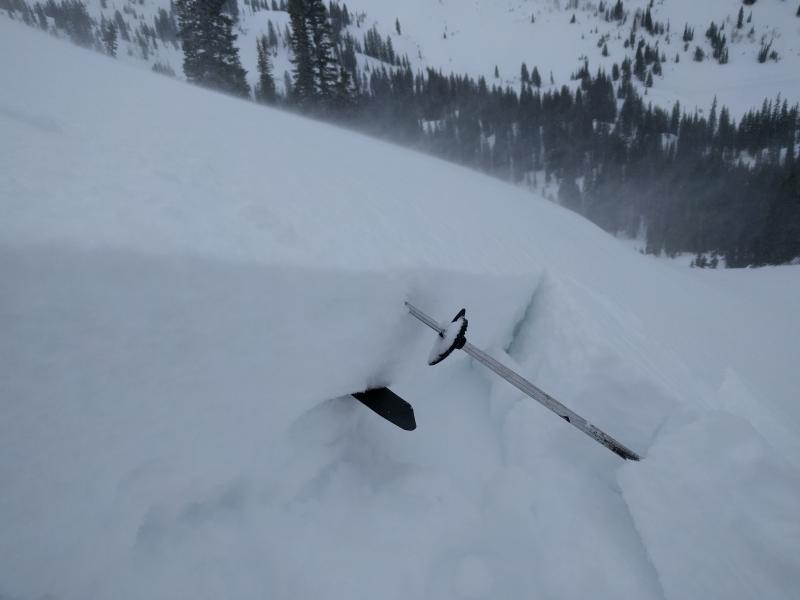
Windslabs were touchy today after 10:30. I crossed 1 wind loaded gulley at 9:45. Light cracking. Crossed same 9300' n facing gulley @ 11:00 got it to crack, fracture, and move 3'. It seemed to have 3 weaknesses. Old Crustbed-new snow interface, new snow windslab interface, and a windowpane thickness on top density change. I also got a small windslab to avalanche in a ski cut. I thought it same weak layers as above and failed to investigate further, But in hindsight i remember no crust where triggered, so slide could have been surface facets.
Avalanche Problem #1
Problem
Wind Drifted Snow
Problem #1 Comments
There are old wind slabs and there are new wind slabs. The old slabs are solid the new slabs are sensitive. It is going to be difficult to tell the difference between the two. An encounter with an old wind slab may give you false confidence of stability. We're supposed to get a new coat of paint. May be hard to tell where any windslabs are period.
Comments
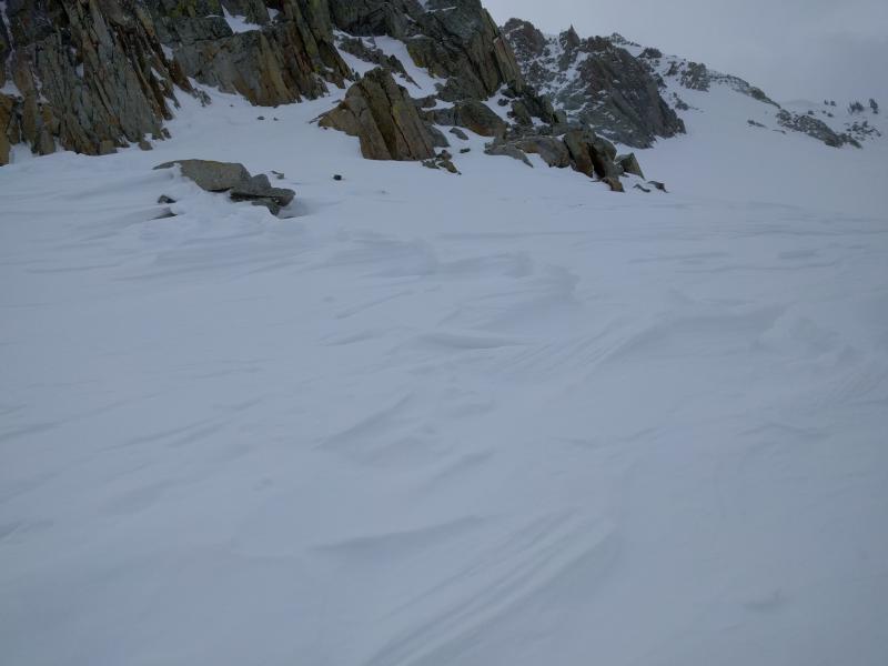
Photos top to bottom 1 cracking. 2.layers. 3. Inverted boot pack wind left behind. 4. Intentionally triggered snowboard cut small windslab.5. bigger windslabs/cornices out there
Today's Observed Danger Rating
Considerable
Tomorrows Estimated Danger Rating
Considerable