Forecast for the Moab Area Mountains

Issued by Eric Trenbeath for
Sunday, January 8, 2017
Sunday, January 8, 2017
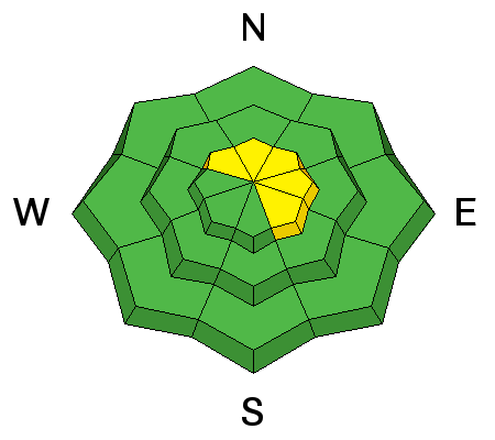
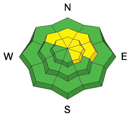
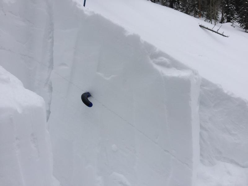
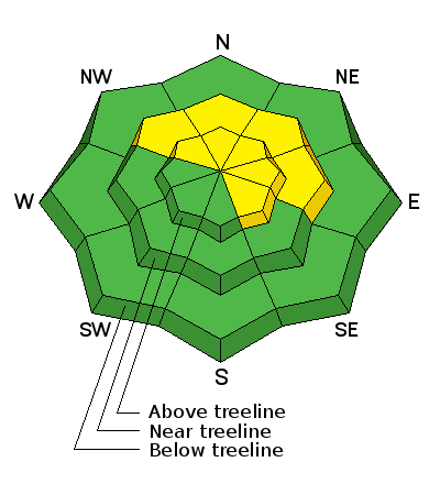
The avalanche danger is MODERATE on steep, upper elevation, wind exposed terrain that has recent deposits of wind drifted snow. The danger is most pronounced on slopes that face N-NE-E, but cross loading has affected terrain on all aspects in the wind zone. Avoid slopes that have smooth, rounded pillows, and suspect the lee sides of terrain features such as sub ridges and gully walls. There is also an isolated or MODERATE danger for triggering a deeper, persistent slab avalanche on upper-mid to upper elevation slopes that face NW-NE-SE. Low elevation offers mostly LOW danger.
Low
Moderate
Considerable
High
Extreme
Learn how to read the forecast here