Forecast for the Abajo Area Mountains

Issued by Eric Trenbeath for
Wednesday, January 4, 2017
Wednesday, January 4, 2017
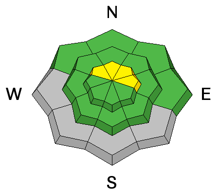
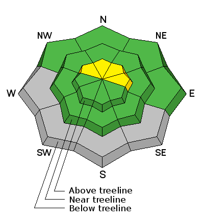
Today there is an isolated or MODERATE avalanche danger in the Abajo/Blue Mountains, particularly on steep, wind drifted, upper elevation slopes that face NW-N-E. Be wary of smooth rounded deposits of wind drifted snow on the lee sides of ridge crests and terrain features such as sub ridges and gully walls. Snow cover remains very thin, and taking a ride in an avalanche in such shallow snow conditions would be a very bumpy ride across the ground. Elsewhere the avalanche danger is generally LOW.
Low
Moderate
Considerable
High
Extreme
Learn how to read the forecast here