Observation Date
1/2/2017
Observer Name
Wilson, Hardesty
Region
Salt Lake » Parleys Canyon » Mt Aire
Location Name or Route
Mt. Aire
Weather
Sky
Obscured
Precipitation
Light Snowfall
Wind Speed
Calm
Weather Comments
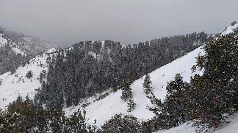
Light snow, calm winds: hard to beat. Occassional peeks at blue, but mostly obscured.
Snow Characteristics
New Snow Depth
4"
New Snow Density
Low
Snow Surface Conditions
Powder
Snow Characteristics Comments
Precipitation apparently started as graupel, but by this afternoon only the lightest and most intricate stellars were falling. New snow adhered poorly to the weak surface in the Mt. Aire area. In steeper areas we had sluffing at the interface, and where wind loading over a sub-ridge formed a soft slab, one small natural (6" x 40', NNE, 7600') had run by the time we arrived. Snow was too light and too little to cover the bumps from the last week's tracks and crusts on steeper slopes, but that could be old news by the time the next rider checks out Mt. Aire.
Avalanche Problem #1
Problem
New Snow
Trend
Increasing Danger
Problem #1 Comments
Between surface hoar (Gagne, Nichols and I observed plenty across a broad elevation swath in Neffs on Saturday) and near surface faceting, the old snow surface was weak. Several inches of light snow didn't tip the scales, but a heavier load--particularly if sintered into a coherent slab by wind--surely would have; or so the one natural seems to suggest. By tomorrow the interface might be slightly stronger but the load significantly heavier. If tonight pulls through with the 4-8" forecasted, we'll likely get some activity in the storm snow.
Snow Profile
Aspect
North
Elevation
7,200'
Slope Angle
34°
Comments
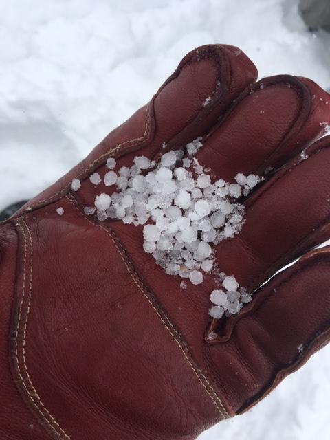
In two north-aspect test pits (7300' and 8400)' only the new/old interface was reactive: failed easily with taps from the wrist in column tests but did not propagate in ECT (no surprise). Both pits showed several inches of new snow over christmas-storm facets. The graupel (but more icy than most graupel) layer from the Mid december storm was about 30 cm down, and under it weak layers and rain crusts make for ugly--but in this case unreactive--structure.
These pellets are a great marker: visible evidence of the mid-december storm in snowpacks from Ogden to Provo
Today's Observed Danger Rating
Moderate
Tomorrows Estimated Danger Rating
Considerable
Coordinates