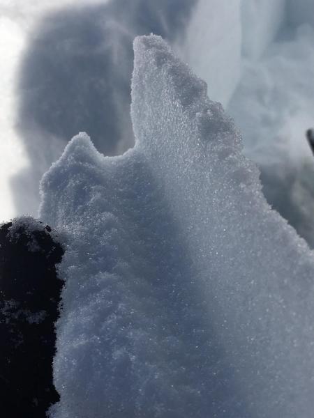
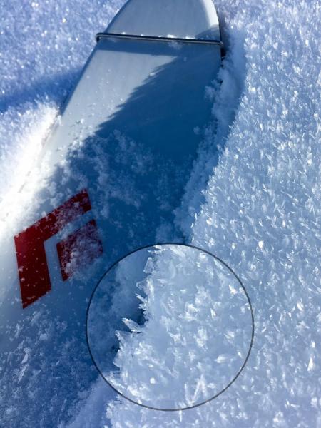
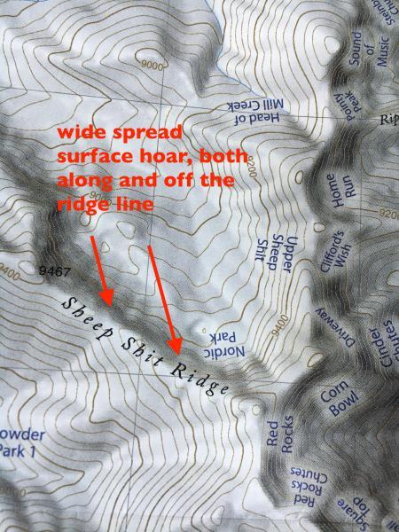
The weakening surface snow is the main concern. On most shady slopes, there is a mix of surface hoar and near surface facets, often several inches thick. The surface hoar is the flashy stuff, but the near surface facets have the potential to be an equally dangerous weak layer. Distribution wise - near surface facets are the most widespread, surface hoar less so. Many have observed the surface hoar in drainage bottoms, but where I was today, I found it to be most widespread along the ridge line, and off the ridge on northerly facing slopes, well into the starting zones and down slope.
The sunny southeast, south and westerly facing slopes are mostly sun crusted, with the crusts of varying thicknesses depending on exact aspect and slope angle.
Recently, I've been searching for shallow snow pack areas to dig pits in. Shallow snow is where the different mid and lower snow pack layers might be the weakest. This might be slopes that have slid one or more times this year, along scoured ridge lines or drainage that get less snow. Where I was, the snow pack ended up being deeper than I would have thought. Looks like some of the shallower areas are across on the other side of Millcreek.
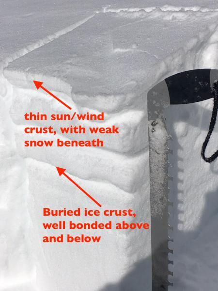
I've also been looking at the buried crusts on southerly facing slopes in several places this week. Today, in a deeper snow pack area, I found the ice crusts to be well bonded above, and just a minor weakness below. This was on a south southwest facing slope, 9350'. No propagation with ECT test, and a CT test was 26, Q2. Instead, the weakest snow was once again near the surface - right below the thin sun/wind crust.
Earlier this week, I looked at a shallow, south facing snowpack at 9800'. While the snow was much weaker, there was still no propagation of ECT above or below the ice crust. Still, it will be worth digging more on southerly facing slopes, and keeping track of these buried sun crusts.