


Forecast for the Uintas Area Mountains

Saturday morning, December 31, 2016
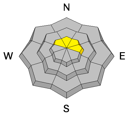
Making up a small portion of the terrain available to ride in, pockets of MODERATE avalanche danger exist today. In the wind zone, at and above treeline, human triggered avalanches are POSSIBLE on steep, wind drifted slopes, especially those with an easterly component to their aspect.
Out of the wind, our snowpack is well behaved and predictable and the avalanche danger is LOW
 Special Announcements
Give the gift that keeps giving and help save a life by doing so. Sign up for one of our Riding Skills and Avy Awareness Workshops given by sledders... for sledders. We've got two workshops this year-
Thursday Jan 19th evening, followed by an on the snow field day Saturday Jan. 21st. Details here.
Thursday Feb. 9th evening, followed by an on the snow field day Saturday Feb. 11th. Details here.
 Weather and Snow
High pressure remains in control of our weather pattern for another day and that of course means valley gunk and fresh clean air in the mountains. Currently, temperatures are in the low to mid teens at most of our remote weather sites and winds are generally westerly, blowing 10-20 mph along the high ridges. Some of our big, open, upper elevation bowls took a hard hit from Tuesdays wind, but lose a little elevation and you'll be treated to premium riding and turning conditions.
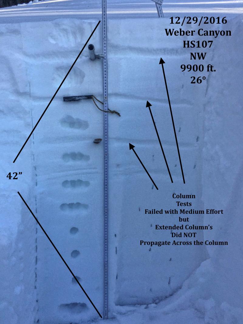
Bomber snowpack in Weber Canyon. JG's beautiful pit profile clearly illustrates why our snowpack is so well-behaved. (JG photo) More on his travels and insight found here.
More snowpack observations and trip reports are found here.
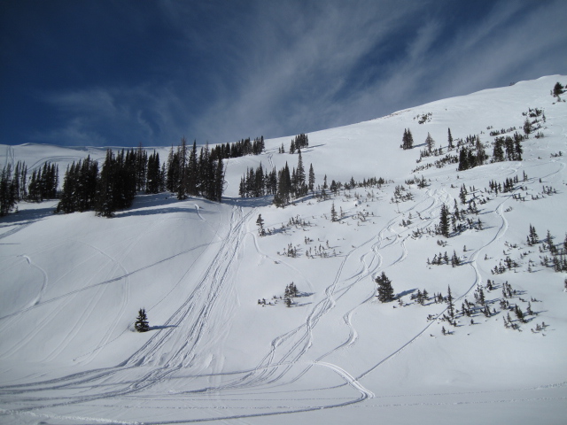
Ted was in the Moffit Basin yesterday and noted that riders are taking advantage of mostly stable snow and getting into some big terrain without incident. (Scroggin photo) More on his travels found here.
Real time wind, snow, and temperatures for the Uinta's are found here.
 Recent Avalanches
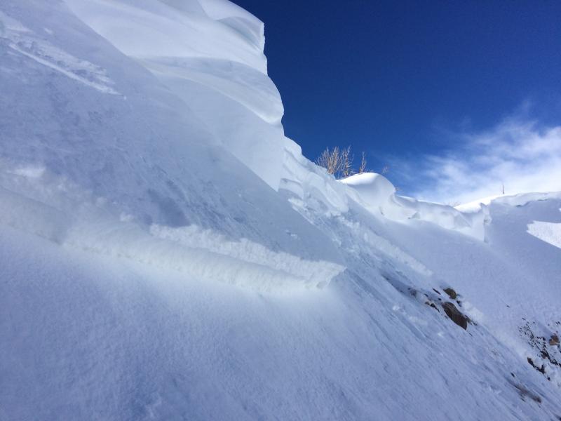
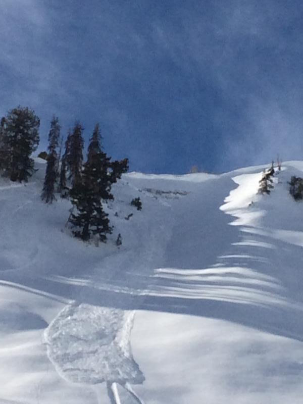
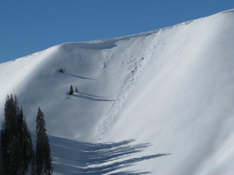
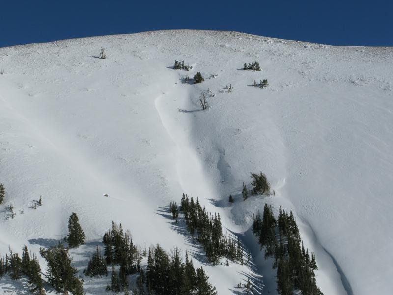
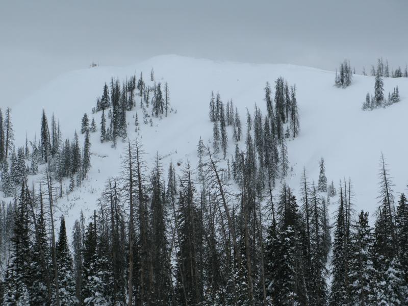
This rider initiated pocket, just underneath the cornice seen in the images above, was about 18" deep x 20' wide. It was triggered yesterday on a steep, upper elevation, east facing, wind drifted slope in Upper Weber Canyon. (C. Brown photo)
A full list of recent Uinta avalanche activity is found here.

Wind Drifted Snow
Description
While not particularly connected and making up a small portion of the terrain available to ride in, pockety wind drifts sensitive to our additional weight can still be found on steep, leeward slopes in the wind zone. A bit less sensitive than previous days, recent drifts could none-the-less break a little deeper and wider than you might expect. I'd continue to avoid any fat, rounded piece of snow, especially if it sounds hollow like a drum.
A quick visual scan of the ridges and terrain features like chutes and gullies, can help you determine where the wind's been blowing and the type of terrain you wanna avoid.
Persistent Weak Layer
Description
Overall our snowpack looks great and most slopes across the range are comfortable in their own skin. However, we do have a few problem children and terrain where the snowpack has remained thin all season, particularly steep, rocky, upper elevation slopes facing the north half of the compass should be considered suspect. Once triggered, an avalanche in terrain with these characteristics can easily get out of hand. If you're getting into the big north facing bowls, think about the consequences of triggering an avalanche that breaks to weak layers near the ground and at the very least, have an exit strategy.
When I think of a place that harbors weak snow and the potential to trigger a deep, dangerous avalanche, Currant Creek Peak always comes to mind. We took a spin out there Tuesday and found mostly supportable snow and a solid snowpack. But with all the great riding options available, there's no reason to tease this slope and roll the dice... this is exactly the type of complex terrain I'd steer clear of.
Additional Information
A storm system diving to the south, ushers in a few clouds for our region, but in general it's gonna be another beautiful day in the mountains. High temperatures bump into the low to mid 30's with overnight lows in the teens. Westerly winds blow in the 20's along the high ridges, but switch to the south on Sunday and increase ahead of an approaching storm system that slides through northern Utah Sunday night into Monday morning. An unsettled weather pattern continues for much of the upcoming week.
General Announcements
Remember your information can save lives. If you see anything we should know about, please participate in the creation of our own community avalanche advisory by submitting snow and avalanche conditions. You can call me directly at 801-231-2170, email [email protected]
The information in this advisory is from the US Forest Service which is solely responsible for its content. This advisory describes general avalanche conditions and local variations always occur.
The information in this advisory expires 24 hours after the date and time posted, but will be updated by 7:00 AM on Sunday January 1st.