Observation Date
12/29/2016
Observer Name
Garcia, Trenbeath
Region
Moab
Location Name or Route
Laurel Highway
Comments
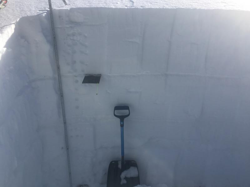
Upon first glance of this pit profile you can see a good number of weaker layers of fist strength beneath the surface. The first layer of concern to me is at 96 cm. It is a 2cm thick layer of graupel and facets. The faceted crystals are 1.5 to 2mm in size. The next layer of concern to me is the facets at 59 cm. These are also 1.5 to 2.0 mm in size. This layer is deeper in the pack and in a zone of low temperature gradient. The layer at 96 cm is in the middle of a larger temperature gradient. So the graupel/facets at 96 may take a bit longer to round out. I expected to see some results on the layer at 96 cm, but it did not react to the compression test, or the extended column test. The results of the compression test today are not of concern to me really. The first failure was CTM 14 Q3 in the upper pack in the middle of a layer at 120 cm. The second failure was CTH 23 Q2 at 58 cm. These facets at 58 cm are still something to keep an eye on. An extended column test produced no results. A lot of words here, and numbers, but I think the overall big picture is that todays stability testing didn't give me any obvious red flags. The snowpack was not talking very much and I think this is a good thing. Overall danger is moderate trending towards low.

Today's Pit on the NNW aspect.
Trenbeath: Snow pack conditions have changed quite a bit since last week and even over the past few days with a strong trend toward stabilization. We felt no collapsing though whumphs were still being reported on Tuesday. Weak layers on northerly aspects, though still present, are no longer reactive. On south facing slopes, a facet/crust layer that was very reactive last week has broken down, and the crystals are trending toward round. We also observed ski tracks on a steep, rocky, north facing slope of around 40 degrees.
Today's Observed Danger Rating
Moderate
Tomorrows Estimated Danger Rating
Moderate


