Forecast for the Abajo Area Mountains

Saturday morning, December 17, 2016
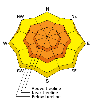
Dangerous avalanche conditions exist in the backcountry. Today the avalanche danger is CONSIDERABLE on all aspects at mid and upper elevations on slopes steeper than about 35 degrees. Human triggered avalanches are likely and backcountry travelers need to possess excellent route finding and terrain selection skills. Stick to sheltered, low angle terrain, and stay off of, and out from under steep slopes today.

 Weather and Snow
I don't have a lot of snow pack information from the Abajo Mountains and I'll be heading down there today to have a look around. Camp Jackson is reporting 8" of new snow at around 9000' and I expect up to a foot up high. Strong SW winds blew yesterday, and the new snow is falling on an extremely shallow, and potentially very weak snow pack. Rocks, stumps, and dead fall are prevalent everywhere.
Additional Information
Today
Snow likely, mainly before noon. Mostly cloudy, then gradually becoming sunny, with a high near 14. Wind chill values as low as -15. Windy, with a northwest wind 20 to 30 mph, with gusts as high as 45 mph. Chance of precipitation is 60%. Total daytime snow accumulation of around an inch possible.
Tonight
Mostly clear, with a low around 7. West northwest wind around 15 mph.
Sunday
Sunny, with a high near 16. Northwest wind around 10 mph.
Sunday Night
Clear, with a low around 11. North northwest wind around 10 mph.
Monday
Sunny, with a high near 24. West northwest wind 5 to 10 mph.


