Observation Date
12/14/2016
Observer Name
Tyler Falk
Region
Salt Lake » Little Cottonwood Canyon » Cardiff Pass
Location Name or Route
Toledo/Cardiff Pass
Weather
Sky
Obscured
Precipitation
Moderate Snowfall
Wind Direction
West
Wind Speed
Light
Weather Comments
Rain and 36 degrees at the base of LCC at noon which changed to snow by tanners and then reached 32 degrees by the time I got to Alta. Snowfall was light to moderate in the afternoon. Temps at 10k. were 27 degrees with light to moderate gusts at times. By the time I drove down the canyon at 5 the snow had stoped and the sky was broken. Only a three degree tempature swing from Alta to the park and ride at the base of the canyon due to the high humidity. (34/37 F) Typicaly with dry air we would expect around a nine degree celisus tempature swing between the 3100 foot or 945 meter elevtion change in the canyon but with moist air is can be as little as half that amount. Alta reported humidity of 92% at 5 pm which seams very high for a time period where it was not raining or snowing.
Snow Characteristics
New Snow Depth
5"
New Snow Density
Medium
Snow Surface Conditions
Powder
Dense Loose
Snow Characteristics Comments
Around 5" of new snow at 9500' in upper LCC. Looks like .38" of water at Alta with 5" reported which makes the density around 8%. Mixed particles including grapuel during the afternoon observed.
Red Flags
Red Flags
Recent Avalanches
Wind Loading
Cracking
Collapsing
Red Flags Comments
Lots of red flags out there today. Plenty of new storm slabs to view between the natural and human triggered variety. Winds were loading lots of slopes on the north half of the compas again. I did not check rapid warming but that might be a concern for 8k and below tomorrw. High tempatures at Alta tomorrow should top out at 40 degrees.
Avalanche Problem #1
Problem
New Snow
Trend
Same
Problem #1 Comments
Widespread storm slabs out there today on a variety of aspects. Noticed them running on steep south facing terrain with slick crusts beneath and also shady north facing terrain which likely was faceted on the surface before the new snow. Wider than expected in may locations. The largest we saw was on Toledo just west of the chute, which was maybe 400 feet wide. Could not get a good picture with the poor visibility. Only five or six inches deep but definitely something to watch in the future once it gets burred.
Avalanche Problem #2
Problem
Wind Drifted Snow
Trend
Same
Problem #2 Comments
Winds were loading lots of terrain on the North half of the compass again. Plenty of snow available for transport. Cornices were starting to form.
Comments
Did not see any avalanches break deeper than the storm snow today. Seamed like a small natural cycle this afternoon in upper LCC where the most snow was received. Grapuel could be a potential suspect in some of the new storm slabs today. Height of snow on south aspects at 10k is around 110 cm. Up to 145cm on high north aspects. Cottonwoods forecast is calling for 2-3" of water weight from this next storm with snow levels at 8k for the first half of the storm. Possibility of wet activity at 9k and below once this storm gets going and the snowpack gets saturated. Looks like the second half of the storm should be right side up.
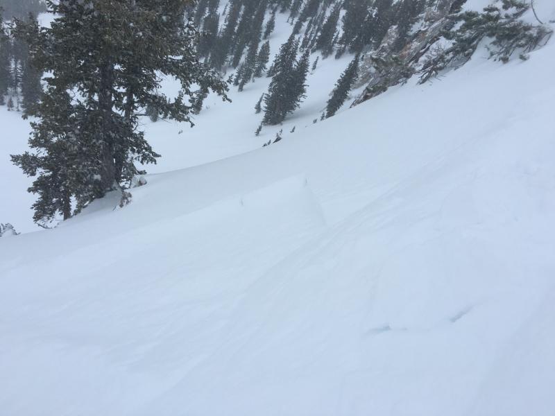
Pic 1. Storm slab in Cardiff behind two trees.
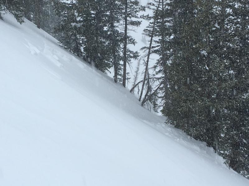
Pic 2. The slide Jake's AAI class remotely triggered on Cardiff Peak.
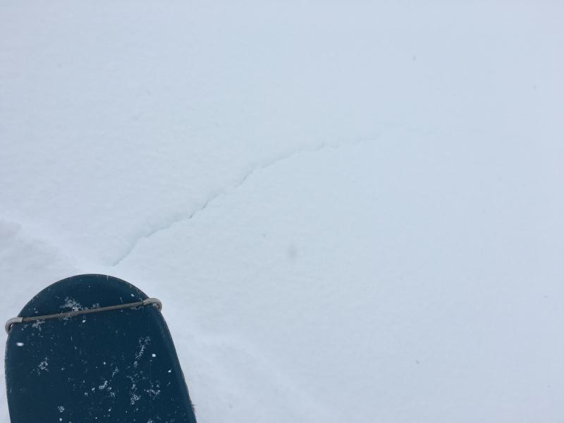
Pic 3. Cracking in the skin track.
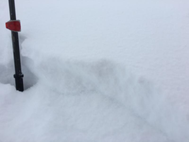
Pic 4. Small storm slab.
Today's Observed Danger Rating
Considerable
Tomorrows Estimated Danger Rating
Considerable