

Forecast for the Skyline Area Mountains

Issued by Brett Kobernik on
Friday morning, December 2, 2016
Friday morning, December 2, 2016
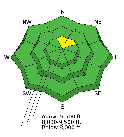
Most of the terrain has a LOW avalanche danger. A MODERATE danger exists on the highest, steepest north through northeast terrain where a lingering wind drift could release.
Low
Moderate
Considerable
High
Extreme
Learn how to read the forecast here
