

Observer Name
Michael Boman
Observation Date
Monday, April 18, 2016
Avalanche Date
Wednesday, April 13, 2016
Region
Salt Lake » Big Cottonwood Canyon » Broads Fork
Location Name or Route
Broads Fork -- Robinsons Variation
Elevation
Unknown
Aspect
East
Slope Angle
35°
Trigger
Natural
Avalanche Type
Glide
Avalanche Problem
Wet Snow
Depth
Unknown
Width
300'
Comments
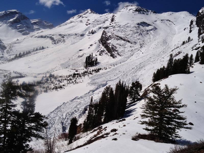
My partner and I hiked/snowshoed the Broads Fork trail Monday morning. There were several large avalanches visible from Robinsons up trail through the easterly facing slopes of Twin Peaks. The avalanche on Robinsons was essentially full-track and looks to have ran about 1,800 vertical feet. The snow at the terminus was up to 10+ feet deep. There was debris entrained throughout the lower third. Definitely a large and destructive avy.
Comments
Looking across the avalanche path from well above the Beaver Ponds
Comments
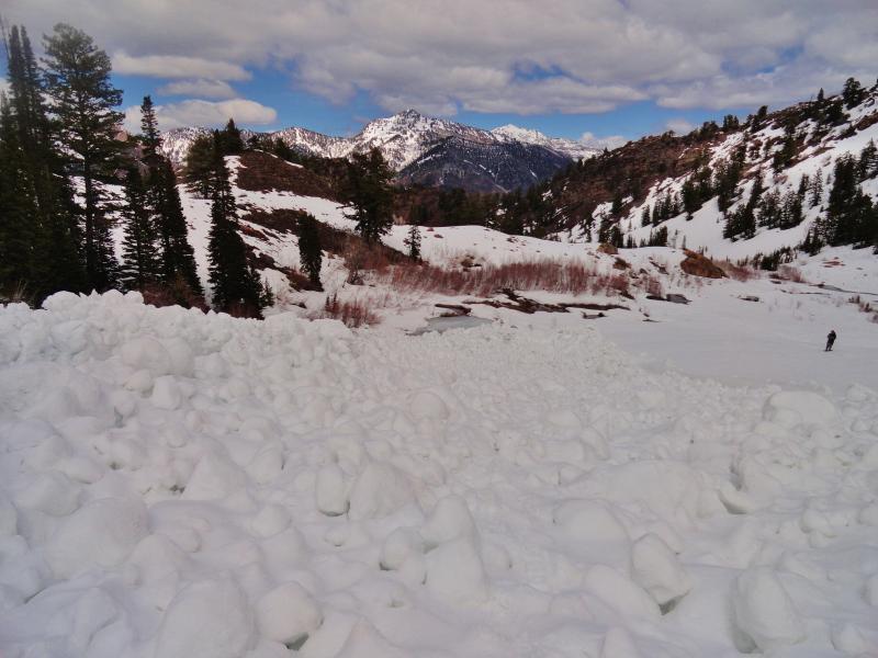
Looking up the avalanche path from it's terminus. Note the debris embedded throughout.
Comments
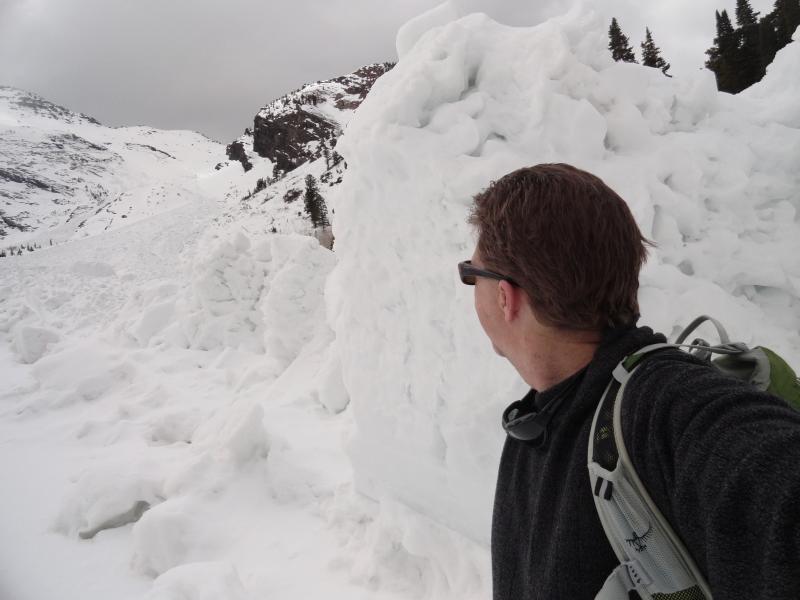
Looking down the bottom of the avalanche. My hiking partner Brett is dwarfed by the slide in this pic.
Video