Forecast for the Moab Area Mountains

Saturday, April 9, 2016
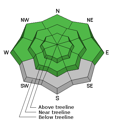
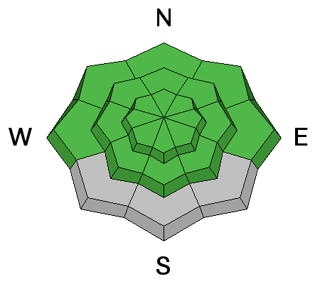
The avalanche danger is generally LOW today.


The avalanche danger is generally LOW today.

This will be our last weekend for regular scheduled advisories. Thanks to everyone who supported the program this season!
Skies are cloudy this morning, southwest ridgetop winds are blowing in the 10-15 mph range, and temps range from 35 degrees at Geyser Pass Trailhead, to 31 in Gold Basin, and 25 on Pre Laurel Peak. The snow surface should be well frozen over this morning, and with continued clouds and a chance of snow in the forecast, it isn't likely to soften much. I'm afraid it's going to be kind of rough out there today.
Winds, temperature and humidity on Pre-Laurel Peak
New snow totals, temperature and humidity in Gold Basin
Total snow depth and temperature at Geyser Pass Trailhead

The avalanche danger is generally LOW. We may see a couple inches of snow during the day, but I don't see it affecting the avalanche danger unless we get significantly more than forecasted. At lower elevations, things may warm up enough to where there will be a slight chance for loose, wet slides, but under mostly cloudy skies, that danger seems remote. Perhaps the greatest danger, though very isolated, will come from cornice fall. Cornices have grown quite large in a few locations. Give them a very wide berth if you are traveling along ridge crests where they are present.
The first in a series of weak systems moving through the desert southwest will affect our area today bringing clouds, scattered snow showers and perhaps a couple inches of snow. Expect a repeat performance on Sunday with a continued unsettled pattern through next week.
Today
Snow showers likely, mainly after 10am. Some thunder is also possible. Cloudy, with a high near 35. Southwest wind 10 to 15 mph. Chance of precipitation is 70%. Total daytime snow accumulation of 1 to 3 inches possible.
Tonight
Snow showers likely before 1am, then a slight chance of snow showers after 2am. Some thunder is also possible. Mostly cloudy, with a low around 27. Southwest wind around 15 mph. Chance of precipitation is 60%. New snow accumulation of less than a half inch possible.
Sunday
Snow showers likely, mainly after noon. Mostly cloudy, with a high near 36. Southwest wind 10 to 15 mph. Chance of precipitation is 60%. New snow accumulation of less than one inch possible.
Sunday Night
A 40 percent chance of snow showers. Mostly cloudy, with a low around 25. Southwest wind around 10 mph becoming northwest after midnight.
Monday
A 50 percent chance of snow showers, mainly after noon. Some thunder is also possible. Mostly cloudy, with a high near 37. North northwest wind 5 to 10 mph.
Road Conditions: The road is plowed down to the dirt and will get muddy in the afternoon.
Grooming Conditons: Grooming is done for the season.
To post an observation go here. You can view Moab observations here. You can also give me a call on my cell phone at 801-647-8896
To receive this advisory by email go here.
This information does not apply to developed ski areas or highways where avalanche control is normally done. This advisory is from the U.S.D.A. Forest Service, which is solely responsible for its content. This advisory describes general avalanche conditions and local variations always exist.