

Forecast for the Uintas Area Mountains

Monday morning, April 4, 2016
As the day heats up, expect the avalanche danger to rise to MODERATE. Human triggered wet slides and sluffs become possible on all steep sunny slopes, especially during the heat of the day.
 Weather and Snow
Currently the 9000' temperatures are 30 degrees and 10,000' temperatures are 27 degrees leading to a decent refreeze of the snow surface. Winds have shifted to the southwest and almost completely died off. Windy Peak sits at 10,600' in elevation and its wind gage reads 5-10mph with an occasional gust to 15 mph. The snow surface is a mixed bag of supportable and unsupportable crusts on all solar aspects. Gain some elevation and swing around to the north where dry cold powder and excellent riding conditions remain.
Uinta weather station network info is found here.
Trip reports and observations are found here.
 Recent Avalanches

Wet Snow
Description
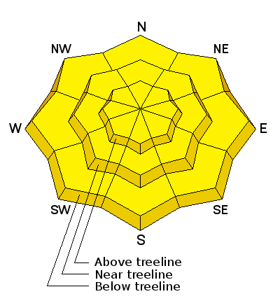
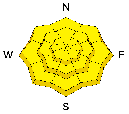
With clear skies and cold temperatures the avalanche danger is generally LOW this morning. However, we will have another round of heat from the strong April sun and wet avalanches are the primary concern. By mid morning the avalanche danger will rise to MODERATE on all aspects and elevations. Fortunately, wet slides and sluffs are easy to manage. As the surface snow heats up or if you find yourself sinking into damp, manky snow, simply get off and out from under steep sun-exposed slopes.
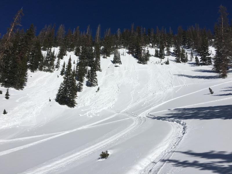
Picture of wet avalanche activity from late in the day Saturday.
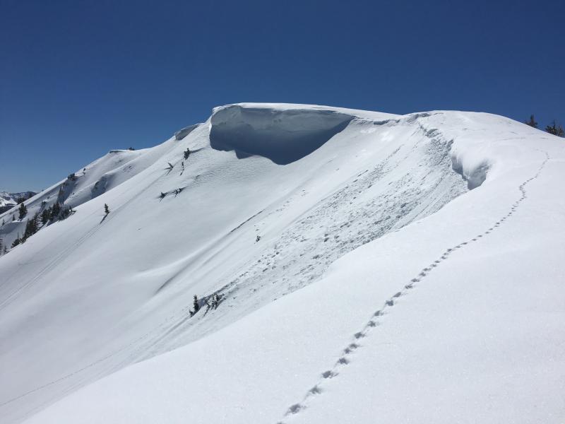
Cornices have grown large and are starting to sag under the intense sun rays. These giant blocks of heavy snow are just waiting to break free and come crashing down. Today you will want to avoid riding below these massive chunks of snow. If you're topping out on ridge line always make sure you give cornices a wide berth. They tend to catch us off guard breaking further back than we might expect.
Additional Information
We have a storm system passing to our north and unfortunately all we are likely to see is a bump in the wind speeds and some clouds. There is a slight chance for a few hit or miss bands of snow with this system. By mid morning you can expect a build up of white puffy clouds and very warm temperatures. Winds will remain from the southwest and should increase to 15-25 mph gusting into the 30's. Overnight lows dip to freezing and colder air moves into the region tomorrow dropping temperatures 10-15 degrees.
General Announcements
Remember your information can save lives. If you see anything we should know about, please participate in the creation of our own community avalanche advisory by submitting snow and avalanche conditions. You can call me directly at 801-231-2170, email [email protected], or email by clicking HERE If Craig is unavailable you can reach his partner Trent at 801-455-7239, email [email protected]
This is a great time of year to schedule a free avalanche awareness presentation for your group or club. You can contact me at 801-231-2170 or email [email protected]. To register for the first in our series of on-the-snow sled specific classes you can register here.
The information in this advisory is from the US Forest Service which is solely responsible for its content. This advisory describes general avalanche conditions and local variations always occur.
The information in this advisory expires 24 hours after the date and time posted, but will be updated by 7:00 AM on Tuesday, April 5th.