

Observation Date
4/3/2016
Observer Name
Bill Hunt
Region
Ogden » Snowbasin Backcountry
Location Name or Route
Snowbasin backcountry
Comments
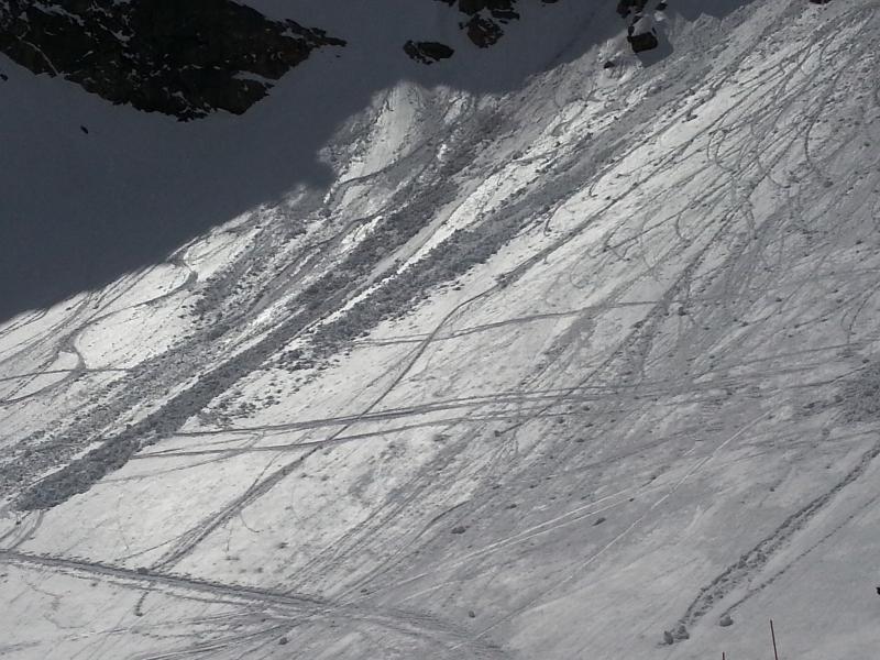
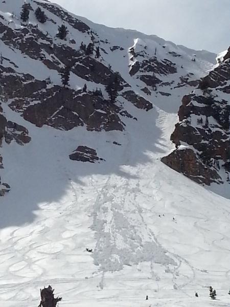
While there were skier-triggered slides on the Fingers chutes the past couple days (East facing, 9300', around 11-12 noon, photo), today there was a significant rollerball cycle in the early afternoon.
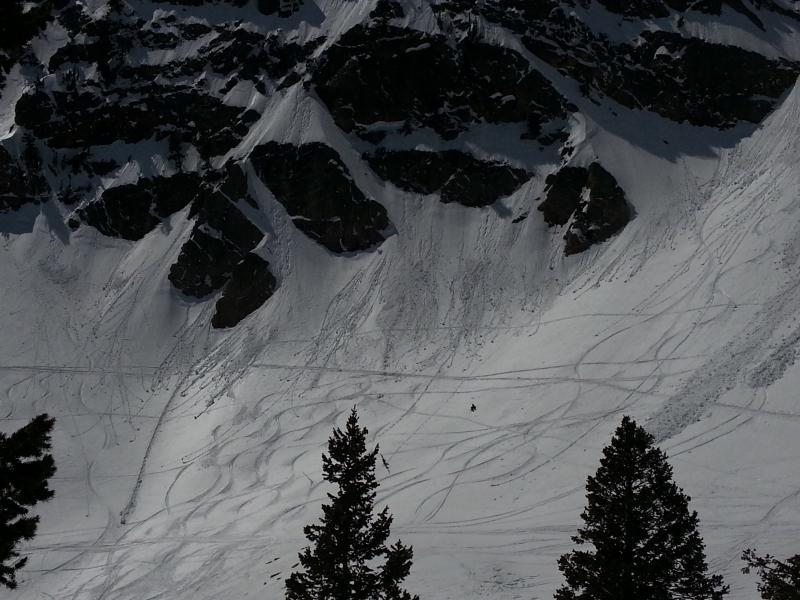
1:55PM: After this area went into the shade, and a few clouds had materialized, we saw a number of releases continuing off the rocks. One triggered a point release on the slope below, 9040' NE facing, running a couple hundred feet.
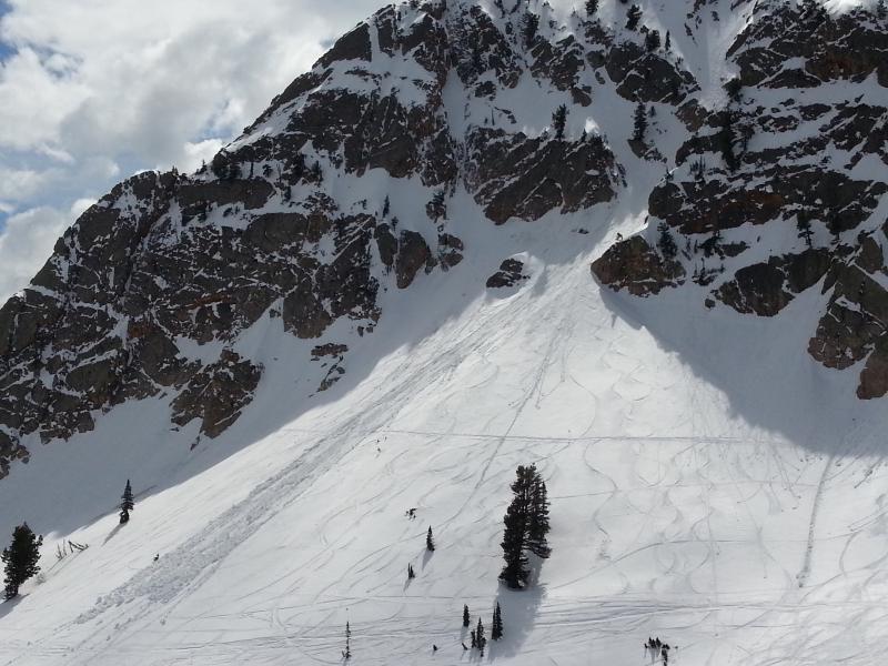
At 2:30PM, we were still enjoying the sun on the John Paul lodge deck, when a sizeable wet natural came out of the Mt Ogden Couloir area.
Some of these chunks looked to be 3-4 feet in diameter.
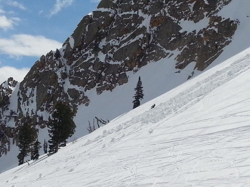
Viewed from Mt Ogden Bowl road, this looked like a point release off the rocks near the base of the chute.
Note that the starting zone rocks are in the shade, and there are a few clouds out; but the heat of the afternoon, and the previous (morning) sun on the NE-facing rocks, was enough to trigger a number of natural point releases off of these rocks, culminating in the 2:30PM slide, which ran down onto a rather low angle slope.
Careful timing before noon tomorrow will be important once again.
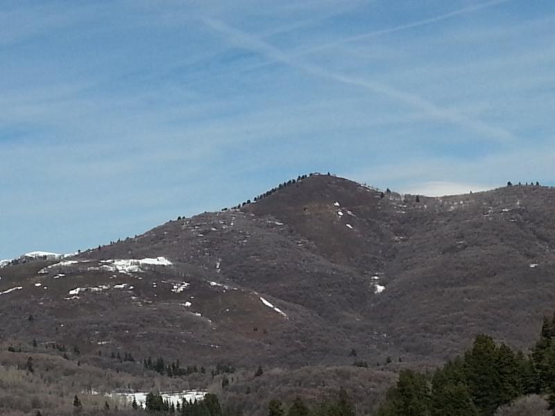
One last thought, the April sun has melted the snow off below 7000', on SE, S, SW aspects (suggestion is for the forecast rose to use grey on those aspects).
Here are S and SE aspects on Sardine peak, 7485 ft at the summit.
Today's Observed Danger Rating
Moderate
Tomorrows Estimated Danger Rating
Moderate