Observation: Whitney Basin

Observation Date
3/29/2016
Observer Name
Ted Scroggin
Region
Uintas » Bear River Ranger District » Whitney Basin
Location Name or Route
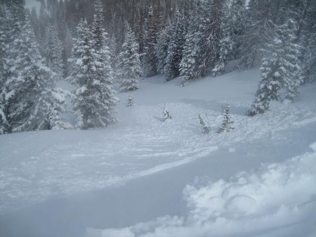
Whitney Basin-Humpy Creek
Weather
Sky
Obscured
Precipitation
Moderate Snowfall
Wind Direction
Southeast
Wind Speed
Moderate
Weather Comments
It was pretty calm weather wise at the trailhead this morning, but once you gained a little elevation into the Whitney Basin it was full on winter. Moderate snow fall, gusty winds and cool temperatures.
Snow Characteristics
New Snow Depth
12"
New Snow Density
Medium
Snow Surface Conditions
Powder
Wind Crust
Snow Characteristics Comments
Not quite blower powder out there today, but the new snow was riding fairly well in the protected areas when you could see in front of you. Where the wind has been moving the snow around somewhat stiff wind drifts were widespread and deep.
Red Flags
Red Flags
Wind Loading
Cracking
Red Flags Comments
Big red flag was the moderate to strong south and southeast winds. With plenty of new snow to blow around fresh and very touchy cornices and soft wind slabs were easily triggered today. Around mid-morning these were barely manageable, but by early afternoon these were packing more of a punch and were more dense.
Avalanche Problem #1
Problem
Wind Drifted Snow
Trend
Increasing Danger
Problem #1 Comments
Fresh wind slabs and very touchy cornices were sensitive today. The first half of the morning these soft slabs were easily triggered along the north facing ridge lines and they were 8-10" deep and fist hardness. But by early afternoon these had become more like 12-14" deep, a little more touchy, more like a 4finger minus in hardness and these were no longer on the manageable side.
Comments
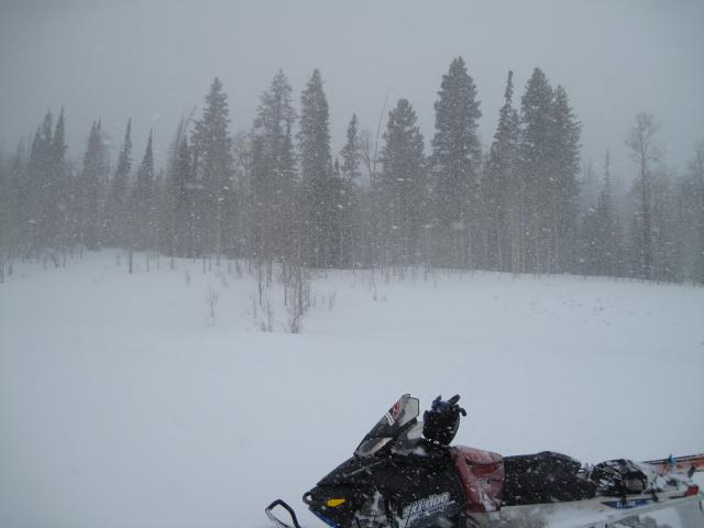
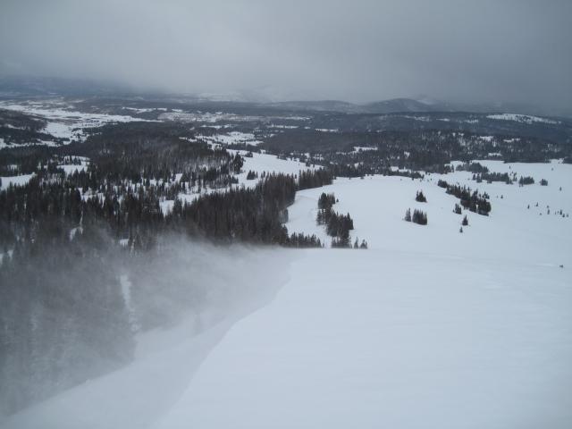
1. It was full on winter this morning riding into the Whitney area with moderate snowfall, gusty winds and visibility was a bit limited at times. 
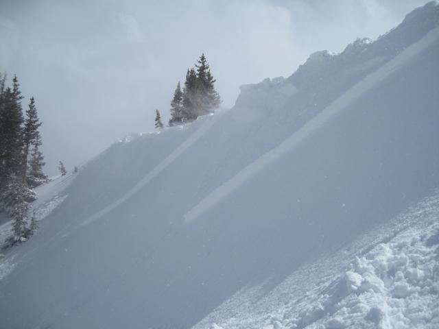
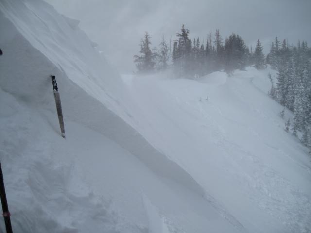
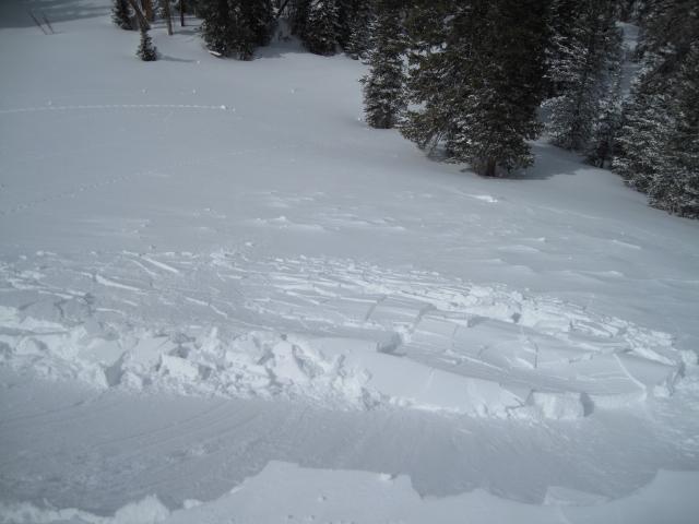
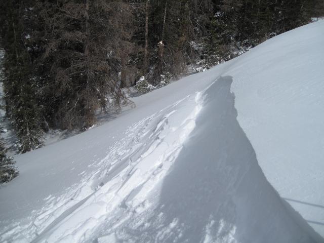
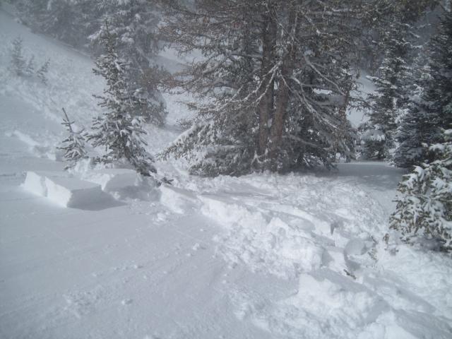
2-4. Very sensitive soft wind slabs off the ridge lines breaking up to 12" deep and 50' wide. 5. Moderate to strong south and southeast winds were drifting lots of new snow creating these sensitive conditions.
Cornices were very touchy and would trigger these soft slabs, some packing a bit of a punch with denser snow.
Today's Observed Danger Rating
Considerable
Tomorrows Estimated Danger Rating
Considerable