

Forecast for the Uintas Area Mountains

Monday morning, March 28, 2016
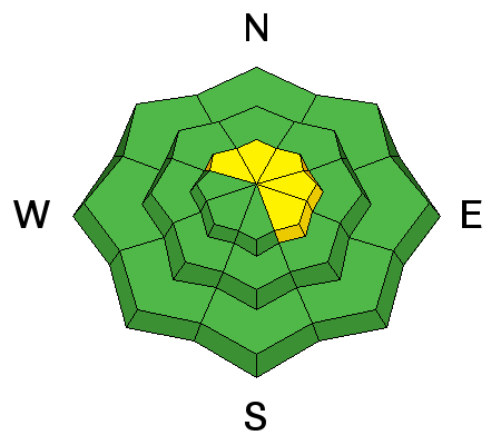
As the storm unfolds expect the avalanche danger to rise accordingly. By days end a MODERATE avalanche danger develops and human triggered avalanches will become possible on steep wind drifted slopes, especially those that face the north half of the compass in the wind zone.
Out of the wind the avalanche danger is generally LOW.
 Special Announcements
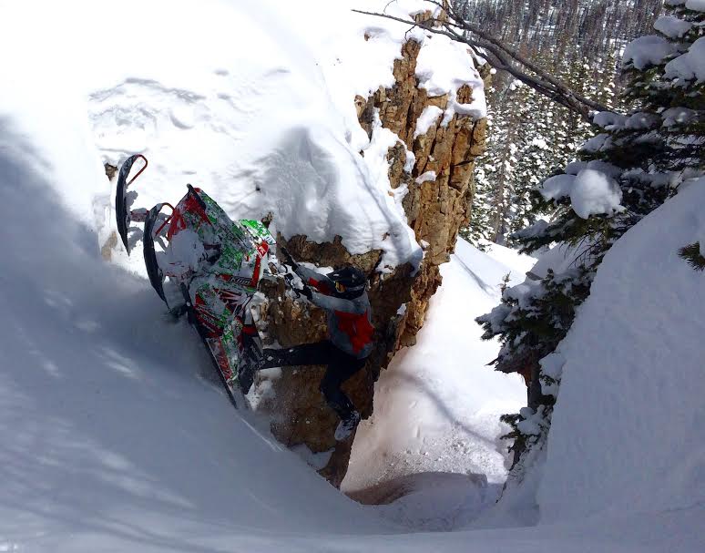
Why yes.... that was the money shot! Huge thanks to Park City Powder Cats for generously hosting another great fundraiser Saturday!
 Weather and Snow
Under mostly cloudy skies, southerly winds continued to ramp up overnight and are currently blowing 40-60 mph with a few gusts in the 70's along the high peaks. Temperatures are relatively mild and in the mid 20's and low 30's. Strong winds and mild temperatures crashed the powder party and all but the most sheltered high elevation, north facing slopes still harbor soft, settled snow.
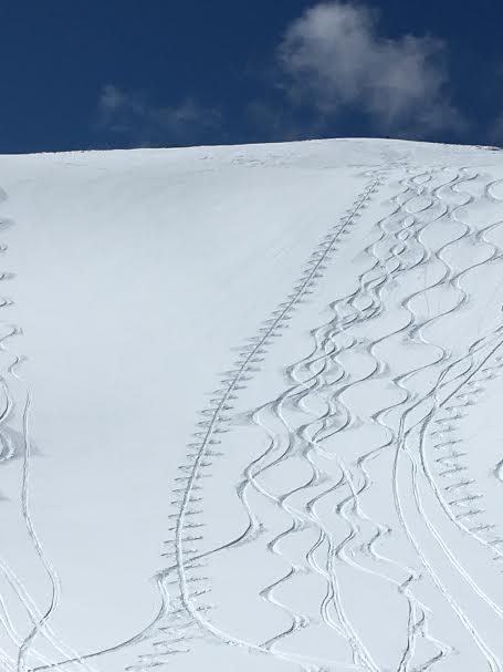
On a go-anywhere base, Zak Collings threads the needle in upper Weber Canyon Saturday.
Uinta weather station network info is found here.
Trip reports and observations are found here.
 Recent Avalanches

Wind Drifted Snow
Description
With a good shot of snow headed our way the next few days expect a rising avalanche danger. As storm snow starts stacking up and winds continue to blow, I suspect fresh wind drifts will become more widespread and sensitive to the additional weight of a rider. Depending on how the storm materializes, drifts may begin to break deeper and wider than you might expect, especially on steep leeward slopes in the wind zone. By now you know the drill- look for clues to unstable snow like shooting cracks around your skis, board, or sled and of course the most obvious... recent avalanche activity.
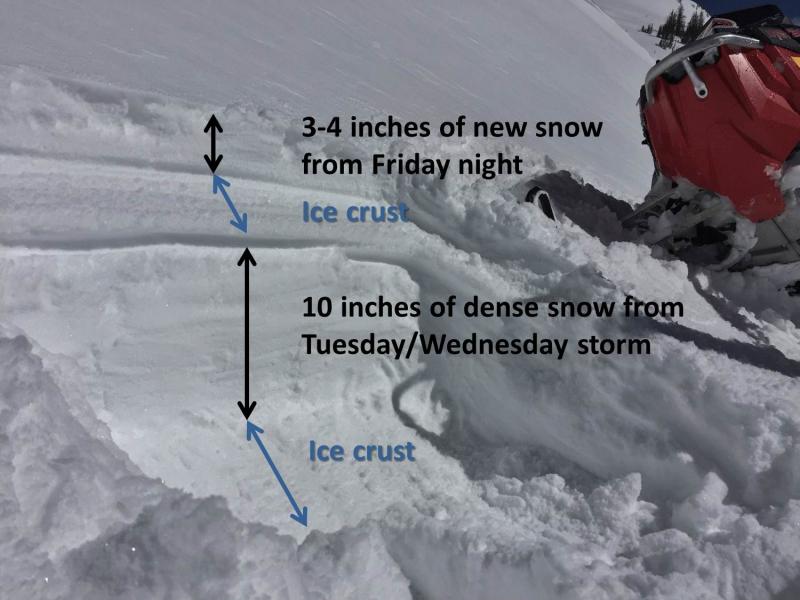
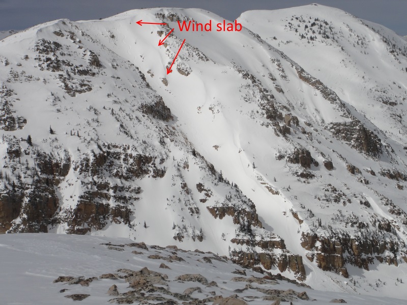
Mark Staples rode out of Smith-Moorehouse Saturday and sent this image in of the typical snowpack structure you're likely to find in that zone. His obs are found here.
Additional Information
A multi-day storm system sets up for the region and we should start seeing snowfall begin later this morning. The big news are the ridgetop winds which should remain strong throughout the day with hourly averages in the 40's and 50's. High temperatures climb into the mid 30's and dip into the 20's overnight. A cold front slides through the region early Tuesday morning and snowfall intensifies, continuing through Wednesday. Storm totals by early Thursday should be in the 12"-18" range. High pressure with warming temperatures returns for late in the week.
General Announcements
Remember your information can save lives. If you see anything we should know about, please participate in the creation of our own community avalanche advisory by submitting snow and avalanche conditions. You can call me directly at 801-231-2170, email [email protected], or email by clicking HERE If Craig is unavailable you can reach his partner Trent at 801-455-7239, email [email protected]
This is a great time of year to schedule a free avalanche awareness presentation for your group or club. You can contact me at 801-231-2170 or email [email protected]. To register for the first in our series of on-the-snow sled specific classes you can register here.
The information in this advisory is from the US Forest Service which is solely responsible for its content. This advisory describes general avalanche conditions and local variations always occur.
The information in this advisory expires 24 hours after the date and time posted, but will be updated by 7:00 AM on Tuesday, March 29th.