


Forecast for the Uintas Area Mountains

Sunday morning, March 27, 2016
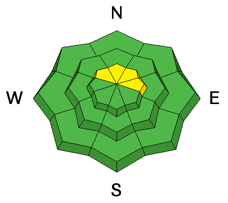
In the wind zone, at and above treeline, pockets of MODERATE avalanche danger exist and human triggered avalanches are possible on steep, wind drifted slopes facing the north half of the compass.
Out of the wind the avalanche danger is generally LOW.
 Special Announcements
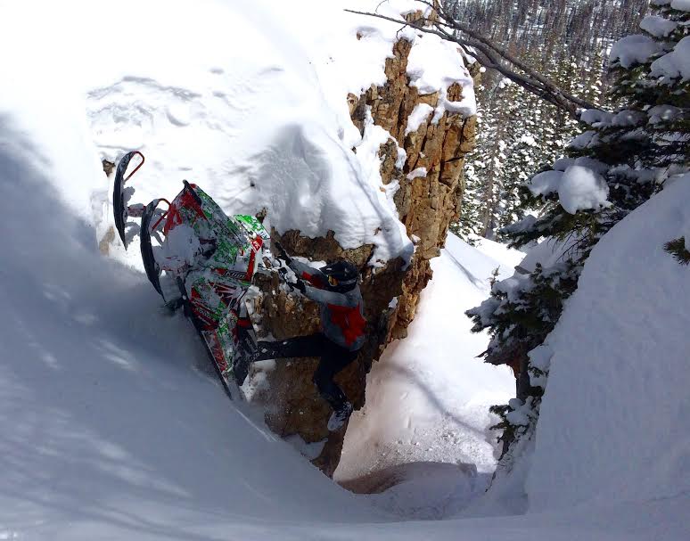
Why yes.... that was the money shot! Huge thanks to Park City Powder Cats for generously hosting another great fundraiser yesterday!
 Weather and Snow
High clouds are drifting into the region ahead of a good looking storm system which should homestead over the area early this week. In the meantime, southerly winds ramped up into the 20's early this morning and temperatures are in the mid teens. Cold settled powder still exists on upper elevation, north facing slopes.
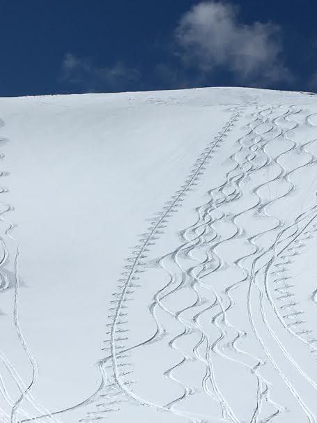
On a go-anywhere base, Zak Collings gets after it in upper Weber Canyon yesterday.
Uinta weather station network info is found here.
Trip reports and observations are found here.
 Recent Avalanches
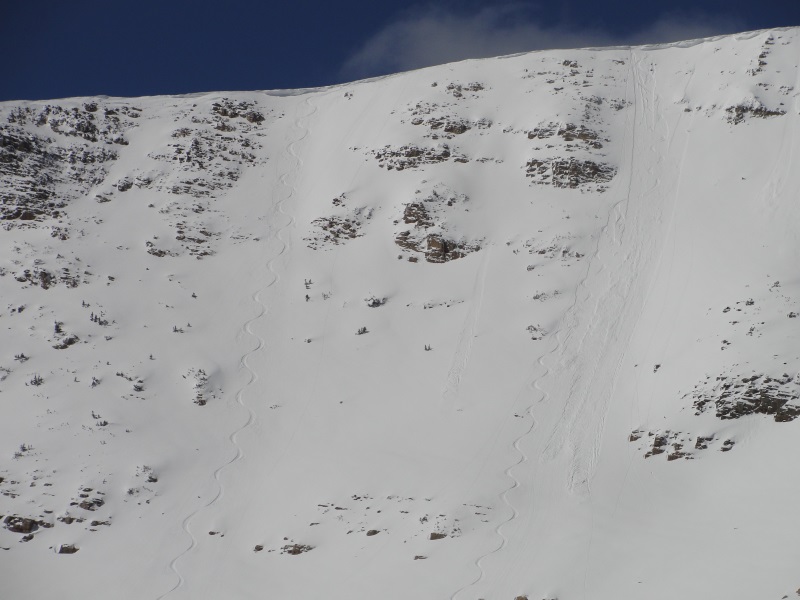
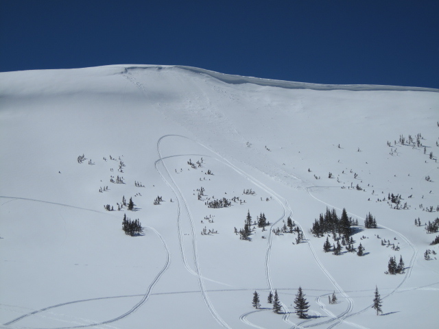
Michael Janulaitis was on Mount Watson yesterday and was able to initiate a shallow soft slab on this very steep northeast facing slope. More on his travels here.
Recent avalanche observations are found here
See or trigger an avalanche? Shooting cracks? Hear a collapse? It's simple. Go here to fill out an observation.

Wind Drifted Snow
Description
In general the snowpack is well-behaved, predictable, and comfortable in its own skin. Of course, the Uinta's are a big range and I bet if you went looking for a shallow slab you could find one sensitive to your additional weight, especially if your travels take you to steep, upper elevation, leeward terrain. While today's drifts are pockety and manageable in depth and width, remember... even a small slide can take you for a fast, unexpected, body-bruising ride, especially in steep, committing terrain.
Ted found a few shallow wind drifts and sensitive cornices in the Double Hill area yesterday.
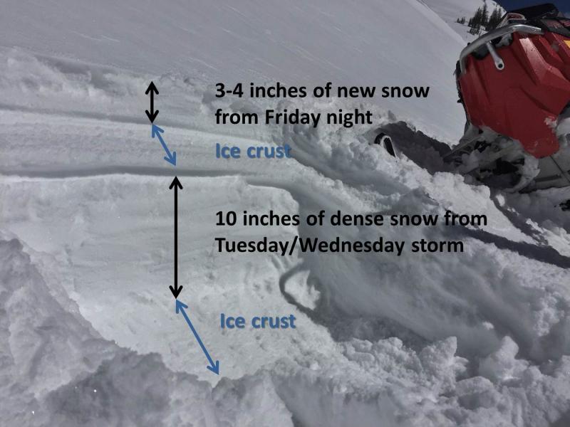
Mark Staples rode out of Smith-Moorehouse yesterday and sent this image in of the typical snowpack structure you're likely to find in that zone. His obs are found here.
Additional Information
The warm before the storm. Expect mostly sunny skies with daytime highs climbing into the low 40's today. Southwest winds increase significantly tonight, blasting into the 60's and 70's along the high ridges. Snow is expected to begin early Monday morning, and a large storm system brings periods of snowfall through Wednesday. Details are still evolving, but right now it looks like a foot of snow is a good bet. We'll have a better handle on the system for tomorrow's update.... don't touch that dial!
General Announcements
Remember your information can save lives. If you see anything we should know about, please participate in the creation of our own community avalanche advisory by submitting snow and avalanche conditions. You can call me directly at 801-231-2170, email [email protected], or email by clicking HERE If Craig is unavailable you can reach his partner Trent at 801-455-7239, email [email protected]
This is a great time of year to schedule a free avalanche awareness presentation for your group or club. You can contact me at 801-231-2170 or email [email protected]. To register for the first in our series of on-the-snow sled specific classes you can register here.
The information in this advisory is from the US Forest Service which is solely responsible for its content. This advisory describes general avalanche conditions and local variations always occur.
The information in this advisory expires 24 hours after the date and time posted, but will be updated by 7:00 AM on Monday, March 28th.