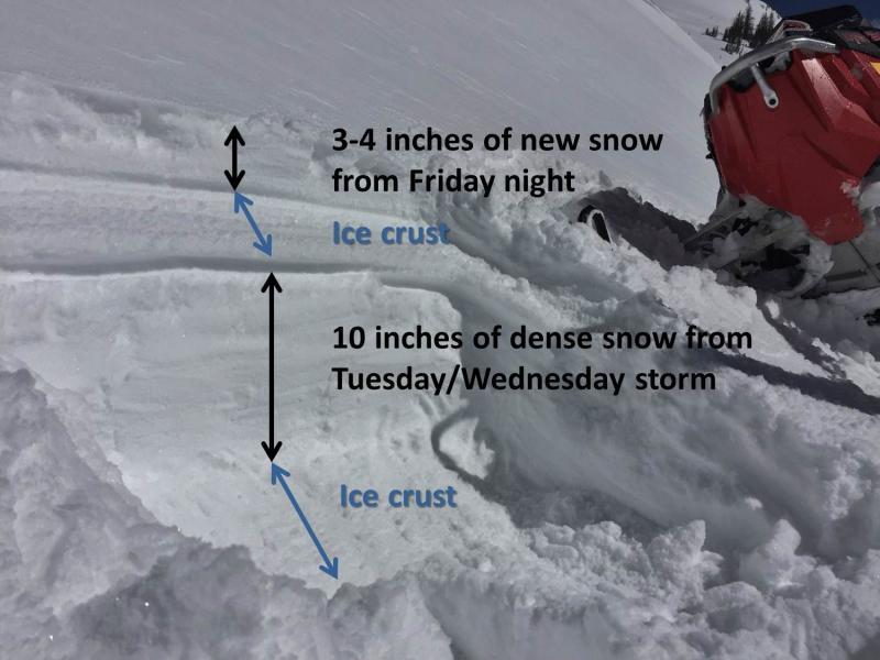
Photo below shows new snow, ice crust, snow from mid week, and another ice crust. This photo was taken on a south aspect at about 10,600 feet. Tomorrow (Sunday) the new 3-4 inches of new snow will easily get wet and slide on the ice crust.
Sidenote - I found some facets near the ice crust 3-4 inches deep in one location and none others. Not a major concern. These facets should be cooked on Sunday by the sun and will not become a problem.
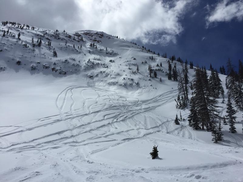
The only avalanche activity we saw is in this photo - the 3-4 inches of new snow sliding on either an ice crust or a hard, wind blown surface.
I dug in this location and was surprised to hit ground so quickly. This demonstrates how big, weak facets still survive on northerly aspects where the snow is thin. I suspect there are many places like this in the Uintas - very rocky with a thin snowpack. This layering is not widespread but a few pockets could avalanche at the ground if we got a major load like 2+ feet of new snow overnight.
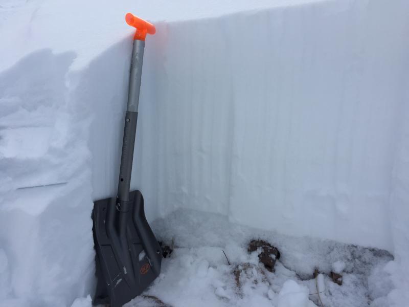
Photo shows pit location where I found very thin snow.