

Forecast for the Uintas Area Mountains

Friday morning, March 25, 2016
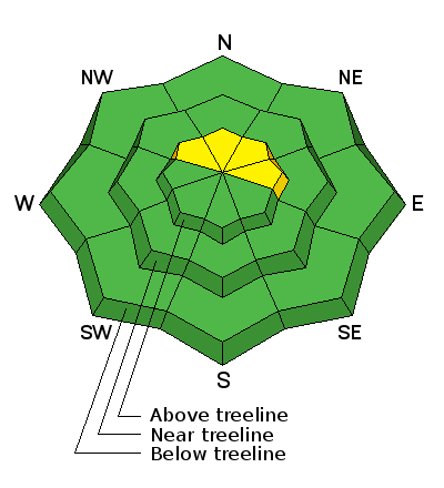
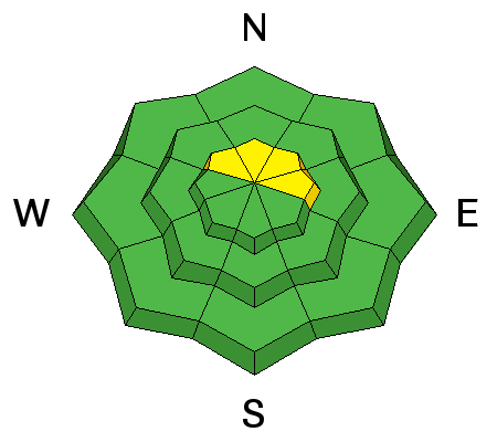
In the wind zone, at and above treeline, pockets of MODERATE avalanche danger exist and human triggered avalanches are possible on steep, wind drifted slopes. While more the exception than the rule, any slide that breaks to old snow near the ground has the potential to break deeper and wider than you might expect and can quickly ruin your day.
Out of the wind the avalanche danger is generally LOW.
 Weather and Snow
While we were sleeping, a weak system slid through the region, coating the area with a trace... maybe even a couple traces of snow. Temperatures are in the upper teens and low 20's. West and southwest winds bumped into the 50's around dinnertime, but have since mellowed into the 30's and 40's where they sit this morning. Snow surface conditions are a mixed bag, but soft creamy powder still exists on wind sheltered, north facing slopes.
Uinta weather station network info is found here.
Trip reports and observations are found here.
 Recent Avalanches

Wind Drifted Snow
Description
Spring is an amazing time of year. It snows, the new snow remains sensitive for a short time, but just a little bit of heat or shot of strong sunshine and things stabilize rather quickly. That was the case yesterday. I found the snow happy in its own skin and nearly every wind drift I stomped on, felt pretty glued in place. Of course, the Uinta's are a big range and I bet if you went looking for a shallow slab you could easily find one sensitive to your additional weight, especially if your travels took you to steep, upper elevation, leeward terrain. So here's the deal. Today's drifts are pockety and manageable in depth and width, but remember... even a small slide can take you for a fast, body-bruising ride, especially in steep, committing terrain. However, lose a little elevation, you lose the problem and get some incredible riding to boot. Not a bad payoff!
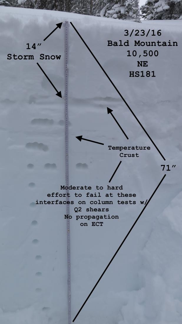
Welcome back JG.... we've missed your detailed pit profiles! More on JG's travels are found here.
Additional Information
Today we can expect mostly cloudy skies and colder temperatures with light snow developing late in the day. Westerly winds gust into the 60's and 70's along the high peaks, but diminish as the day wares on. High temperatures climb into the upper 20's and dip into the teens overnight. A quick shot of snow slides through the region tonight with 3"-6" expected by Saturday morning. Skies clear early Saturday as short-lived high pressure builds through Sunday. A cold, unsettled pattern sets up for much of next week.
General Announcements
Remember your information can save lives. If you see anything we should know about, please participate in the creation of our own community avalanche advisory by submitting snow and avalanche conditions. You can call me directly at 801-231-2170, email [email protected], or email by clicking HERE If Craig is unavailable you can reach his partner Trent at 801-455-7239, email [email protected]
This is a great time of year to schedule a free avalanche awareness presentation for your group or club. You can contact me at 801-231-2170 or email [email protected]. To register for the first in our series of on-the-snow sled specific classes you can register here.
The information in this advisory is from the US Forest Service which is solely responsible for its content. This advisory describes general avalanche conditions and local variations always occur.
The information in this advisory expires 24 hours after the date and time posted, but will be updated by 7:00 AM on Saturday, March 26th.