Observation: Emma Ridges

Observation Date
3/15/2016
Observer Name
Tyler Falk
Region
Salt Lake » Little Cottonwood Canyon » Emma Ridges
Location Name or Route
Emma Ridge
Weather
Sky
Obscured
Precipitation
Light Snowfall
Wind Direction
West
Wind Speed
Moderate
Weather Comments
Light to moderate snowfall in upper LCC through 3 pm when I left. Colder tempatures allowed dryer snow to fall in the seccond part of this storm. I noticed below freezing tempatures on my drive down canyon all the way from Alta to the mouth of the canyon at 3pm where the temps were just at freezing. Winds were from the West to Southwest on 10kk ridgelines transporting snow at times to Northeast trhough East terrain.
Snow Characteristics
New Snow Depth
18"
New Snow Density
Medium
Snow Surface Conditions
Powder
Snow Characteristics Comments

Storm snow in upper LCC ranged from a foot at 8600 to eighteen inches at 9800. Medium to light density snow on top of some grapuel and heavier snow made the storm right side up. I saw my shadow a a few breif times around midday but the post frontal showers won over.

Red Flags
Red Flags
Heavy Snowfall
Wind Loading
Cracking
Red Flags Comments
Defnitily a few red flags out there today with the new snow and wind.
Avalanche Problem #1
Problem
Wind Drifted Snow
Trend
Same
Problem #1 Comments

Strong West to Southwest winds loaded and cross loaded a number of slopes.

Avalanche Problem #2
Problem
New Snow
Problem #2 Comments

Where the snow fell on smooth hard surfaces it did not bond well. Especially steep south where I heard about a number of storm slabs moving on the old tired snow.

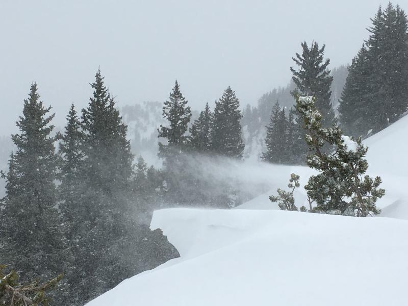
Photo 1. Snow transporting to NE aspects.

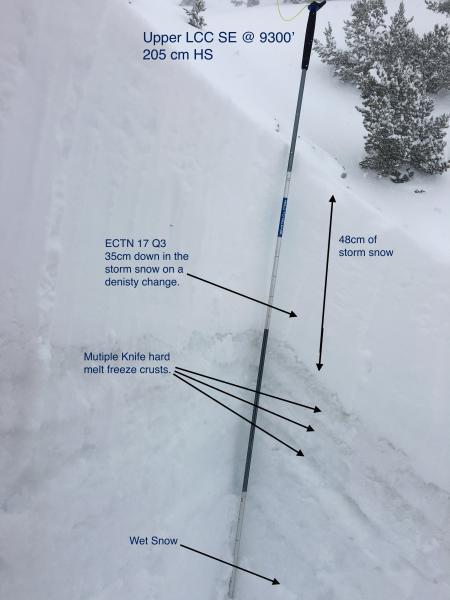
Photo 2. SE aspect at 9300'

Today's Observed Danger Rating
Moderate
Tomorrows Estimated Danger Rating
Moderate