Forecast for the Abajo Area Mountains

Eric Trenbeath
Issued by Eric Trenbeath for
Sunday, March 13, 2016


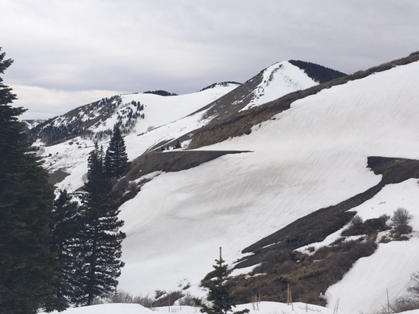
Most terrain offers generally LOW danger. Isolated shallow wind slabs may exist the lee sides of ridge crests and terrain features, in upper elevation, wind exposed terrain. Minor, loose wet sluffs are also a possibility on sun exposed slopes.

Low
Moderate
Considerable
High
Extreme
Learn how to read the forecast here
Special Announcements

The Abajo / Blue Mountain advisory provides detailed snow, mountain weather, and avalanche information on weekends. During the week, an overall danger rating will be provided with current condition information available through the weather links below.

Confused about danger ratings and how to apply them to your terrain choices? Check out this great video produced by the USFS National Avalanche Center.

Weather and Snow

Skies are clear this morning and temperatures are in the mid 20's at 10,000' and 30 at Buckboard Flat. Winds on Abajo Peak are light and westerly.

Things are looking a little tired and worn down in the Abajo/Blue Mountains. South facing slopes are nearly melted out, and the existing snow surface is mostly crusted over. Some soft powder-like conditions can still be found in sheltered, shady aspects.

Winds, temperature and humidity on Abajo Peak.

Snow totals at Buckboard Flat.

Snow totals at Camp Jackson.

Avalanche Problem #1
Normal Caution
Type
Location
Likelihood
Size
Description

The avalanche danger is mostly low at this time. But low danger means that problems may still exist on isolated terrain features. Here are a few problems to remain aware of:

Wind Slabs: Isolated wind slabs may still exist on the lee sides of ridge crests and terrain features in upper elevation, wind exposed terrain, primarily on slopes with a N-NE-E aspect.

Persistent Slabs: It may still be possible to trigger a slab on weak sugary, faceted snow in areas of steep, rocky, and more extreme northerly facing terrain. Slide paths that are repeat runners are also suspect.

Loose Wet: If the sun comes out and slopes heat up, the danger remains for loose wet slide activity on sun exposed slopes.

Additional Information

A storm system will track through to the north later today bringing us mostly cloudy skies and a chance of snow on Monday.

Today

Partly sunny, with a high near 37. Breezy, with a west northwest wind 10 to 15 mph becoming southwest 20 to 25 mph in the afternoon. Winds could gust as high as 40 mph.

Tonight

A 20 percent chance of snow showers after 7pm. Mostly cloudy, with a low around 27. Windy, with a west southwest wind 30 to 35 mph, with gusts as high as 45 mph.

Monday

A 30 percent chance of snow showers, mainly after 4pm. Partly sunny, with a high near 36. Very windy, with a west wind 35 to 40 mph, with gusts as high as 60 mph.

Monday Night

A 30 percent chance of snow, mainly before midnight. Mostly cloudy, with a low around 19. Windy, with a northwest wind 30 to 35 mph decreasing to 20 to 25 mph in the evening. Winds could gust as high as 50 mph.

Tuesday

Mostly sunny, with a high near 29. Blustery, with a northwest wind 20 to 25 mph, with gusts as high as 35 mph.

General Announcements

Let me know what you are seeing down there by posting an observation here. You can also call me on my cell phone at 801-647-8896

To receive this advisory by email go here.

This information does not apply to developed ski areas or highways where avalanche control is normally done. This advisory is from the U.S.D.A. Forest Service, which is solely responsible for its content. This advisory describes general avalanche conditions and local variations always exist.