Forecast for the Abajo Area Mountains

Issued by Eric Trenbeath for
Monday, March 7, 2016
Monday, March 7, 2016
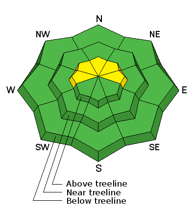
Today there is a MODERATE avalanche danger for recently deposited wind slabs on the lee sides of ridge crests and terrain features in upper elevation, wind exposed terrain. Look for signs of instability such as cracking in the snow surface, and characteristic smooth rounded pillows of freshly drifted snow.
Low
Moderate
Considerable
High
Extreme
Learn how to read the forecast here