UDOT PLANNED AVALANCHE CLOSURES!!

Forecast for the Logan Area Mountains

Toby Weed
Issued by Toby Weed on
Sunday morning, January 31, 2016

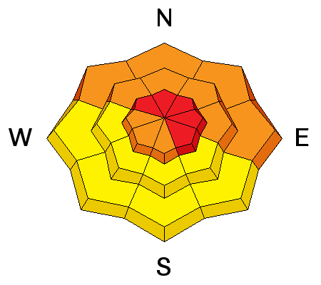
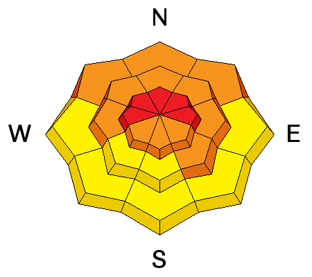
HIGH (level 4): Dangerous avalanche conditions exist in the backcountry. Human-triggered avalanches are likely on slopes with significant fresh accumulations steeper than about 30 degrees, especially in drifted upper elevation terrain. We recommend that you continue to stay off of and out from under steep slopes and avoid obvious and historic avalanche paths.

Low
Moderate
Considerable
High
Extreme
Learn how to read the forecast here
Weather and Snow

The temperature is 11 degrees at the 8400' Tony Grove Snotel and there are several more inches of light new snow from yesterday capping heavier snow from Friday night. The snow pillow reports a gain of 2.8 inches of water in the last 72 hours, and I'm reading 79 inches of total snow, containing 109% of average water content for the date. The 9700' CSI Logan Peak weather station reports 7 degrees and the wind sensor appears rimed. The UDOT Hwy 89 summit weather station reports 6 degrees and light to moderate wind from the northwest overnight, veering from the east with speeds in the single digits this morning. Dangerous conditions exist in the backcountry, and people should avoid travel in avalanche terrain today. Human triggered avalanches are likely.​ We recommend you stay off of and out from under obvious or historic avalanche paths and slopes steeper than about 30 degrees.

Recent Avalanches

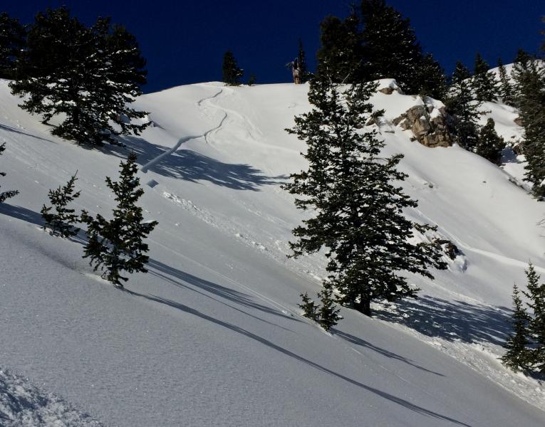
A skier triggered and then escaped this shallow wind slab avalanche in Wildcat Bowl in the Wood Camp Area on Wednesday (1-27-16). Several other similar (apparently manageable) avalanches were triggered by people locally last week.


Ski Areas in the Ogden Area Mountains report active avalanche conditions yesterday, with numerous avalanches (some fairly large) intentionally triggered by avalanche control teams. A hiker on snow-shoes triggered and may have been caught in a loose (wet?) avalanche at the mouth of Logan Dry Canyon yesterday. We received few other reports locally from the backcountry, and with poor visibility of avalanche terrain, we're faced with a high degree of uncertainty regarding yesterday's probable natural activity.


There were several (apparently manageable) human triggered avalanches last week. These on north through east facing upper and mid elevation slopes were around a foot deep and up to about 50' wide.


A video posted on Facebook from a large sled triggered avalanche (1-19-16) in Christmas Tree Bowl is .....HERE

***To view our updated list of backcountry observations and avalanche activity from around Utah, go to our observations page

Ad
Avalanche Problem #1
New Snow
Type
Location
Likelihood
Size
Description

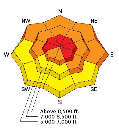
Storm slab and/or wind slab avalanches including the new snow and failing within or on preexisting weak surface snow are likely in steep terrain today.

  • We've noticed the development of small sugary faceted snow and areas with feathery surface hoar on the snow surface last week. If the weak surface snow was buried intact by Friday's light snow before being destroyed by warmth, rain, or wind, it is likely to be the failing layer for today's storm slabs. The buried weak snow may turn out to be a longer lasting persistent weak layer.
  • Strong southwest winds accompanied heavy snowfall Friday night, and drifting probably occurred well off the major ridge tops. These drifts are now buried and obscured by yesterday's lighter powder. It won't take much wind to form new drifts today with yesterday's light snow, especially at upper elevations. Watch for and avoid slopes with recent stiffer deposits of drifted snow, particularly near ridge tops and in and around terrain features like gullies, sub-ridges, scoops, and rock outcroppings.
Avalanche Problem #2
Persistent Weak Layer
Type
Location
Likelihood
Size
Description

Heavy new snow, rain-on-snow at lower elevations, and strong winds overloaded a complex snowpack, with existing buried persistent weak layers in some areas and still weak basal layer depth hoar in others.

  • Triggered deep slab avalanches are likely in some areas today. Snowpit tests during the week showed reasonable stabilization of the buried January persistent weak layers in most areas. But, I was able to find moderate failures and slab propagation in some places. Weak snow structure exists mainly in areas where the slab from last week's snow is 2' deep or less, including in shallow lower and mid elevation areas and on generally south facing slopes.
  • In areas with particularly poor snow structure, the weak faceted snow in the basal layers of the snowpack might be reactivated by the added weight of this weekend's fresh snow. Dangerous and destructive​ deep slab avalanches involving old snow and failing on sugary faceted snow or depth hoar are possible, especially in areas with shallow overall snow cover.

***Pay close attention to signs of unstable snow like recent avalanches, whumpfing, and shooting cracks, and be willing to reevaluate your plans. In these conditions you could trigger avalanches remotely, from a distance or worse, from below!

Additional Information

A WINTER STORM WILL AFFECT MOSTLY SOUTHERN AND CENTRAL UTAH THROUGH MONDAY NIGHT...BRINGING SIGNIFICANT SNOW ACCUMULATIONS AND GUSTY WINDS. COLD NORTHERLY FLOW WILL FOLLOW ACROSS THE REGION FOR THE MIDDLE PORTION OF NEXT WEEK.

Weather Forecast: Tony Grove Lake (41.897,-111.6535), Elevation: 8800'
Today: A slight chance of snow showers before 11am, then a slight chance of snow after 11am. Cloudy, with a high near 18. West northwest wind 5 to 7 mph becoming calm. Chance of precipitation is 20%.
Tonight: A 30 percent chance of snow, mainly after 11pm. Mostly cloudy, with a low around 8. Wind chill values as low as -9. East northeast wind 6 to 16 mph. New snow accumulation of less than a half inch possible.
Monday: A 30 percent chance of snow. Cloudy, with a high near 17. Wind chill values as low as -10. East northeast wind 8 to 17 mph becoming north in the afternoon. New snow accumulation of less than one inch possible.

General Announcements

Please submit snow and avalanche observations from your ventures in the backcountry HERE. You can call us at 801-524-5304 or email HERE, or include #utavy in your Instagram or Tweet us @UAClogan. To report avalanche activity in the Logan Area or to contact the local avalanche forecaster call me, Toby, at 435-757-7578.

I'll update this advisory throughout the season on Monday, Wednesday, Friday, and Saturday mornings by about 7:30

This advisory is produced by the U.S.D.A. Forest Service, which is solely responsible for its content. It describes only general avalanche conditions and local variations always exist.