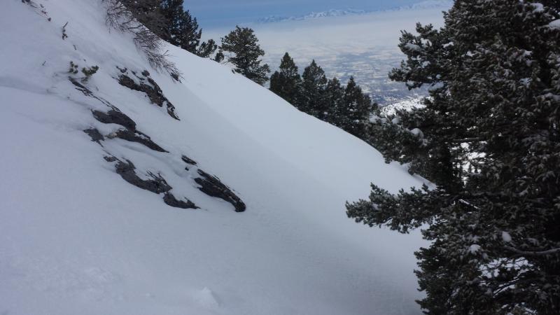
First set of photos are from the Hells area ( Snowbasin Periphery)
1. Fresh wind slab on buried surface hoar from yesterday.
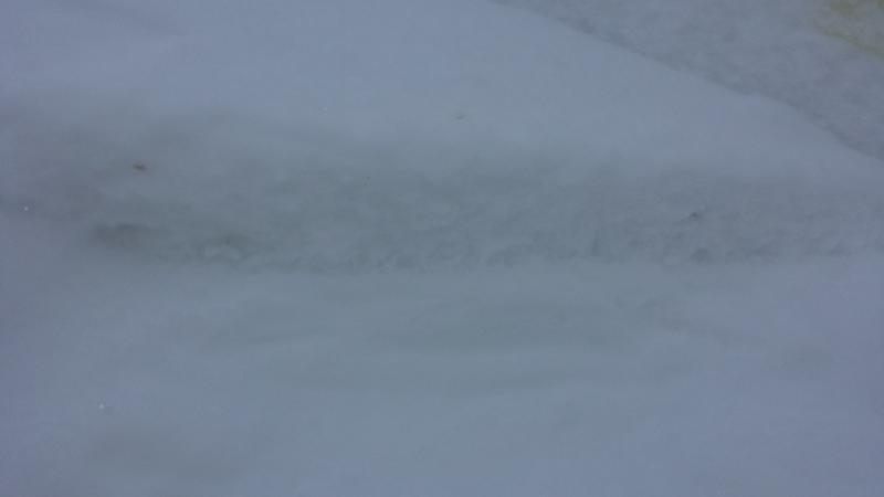
2. Buried surface hoar that these wind slabs are failing on.
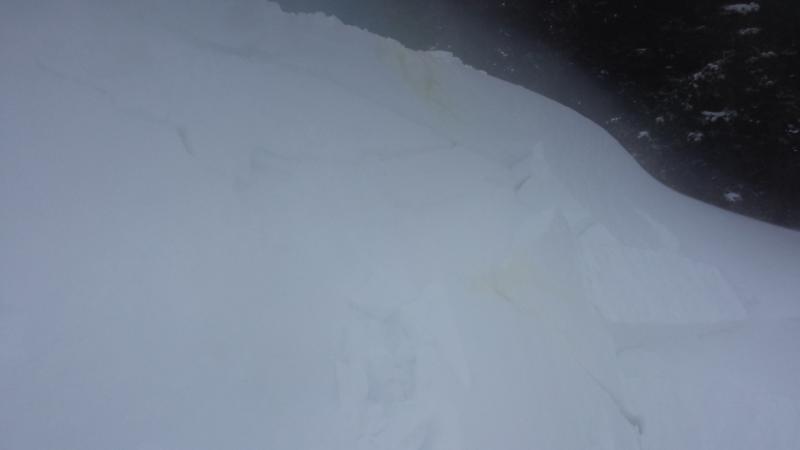
3. Start zone to prominent path with surface hoar under new snow from the morning of 1/29/2016
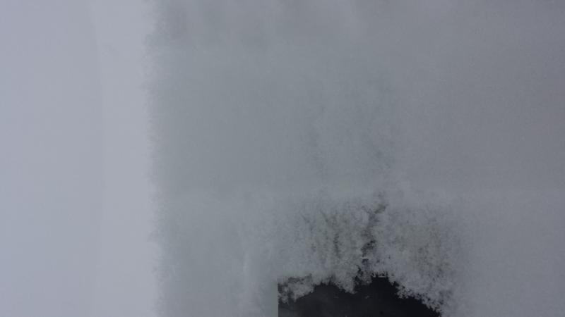
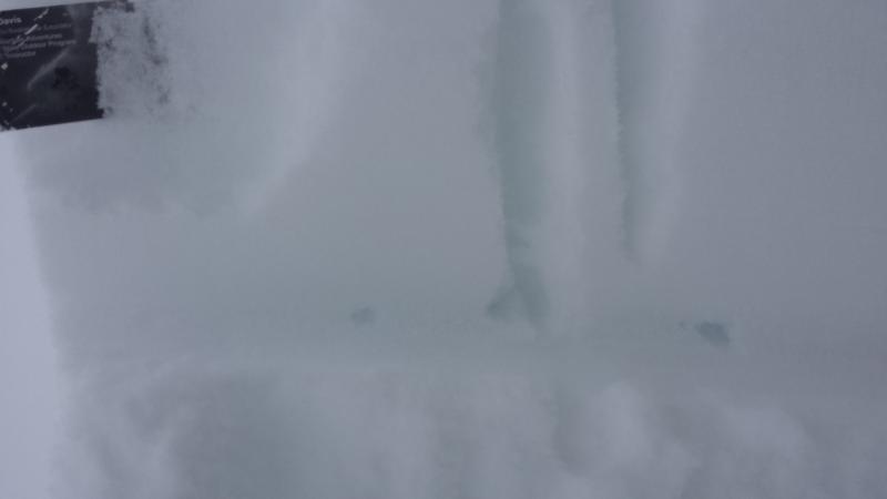
These obs are from the North Ogden Divide.
1. Buried surface hoar 3-6mm 7 cm down
2. Old snow surface from Jan 21. Now a slick bed surface and also has weaker 4f snow underneath.
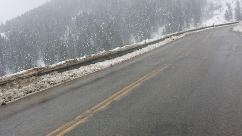
3. Heavy Precip around 4:30 pm

Shovel Tilt failing on Jan 21st snow surface. Shovel shear failing on lower layer that had no ECT failure. Shovel tilt failing on surface hoar. Pinwheel on E aspect (it rolled down next to me for awhile just couldn't get camera out in time).
With our quick shot of snow last night in the Ogden mountains we received 2.5in at Powder 2in at the Ben Lomond trail and peak and 1in at Snowbasin. Here at the Huntsville weather station we received 2 inches of low to moderate density snow. Last nights storm came in slow with calm winds. In the Ogden Mountains winds were moderate which could have preserved the NSF and Surface hoar in the Ogden Mountains. Sustained winds on Mt. Ogden were in the 20s with gusts to the 50’s where at all other weather stations winds were in the teens with gusts to the twenties.
Snow came in heavy and began around 2:00 pm and increased in intensity and was S2 around 3:45pm. We saw a very wet snow but no rain. The snow rain line seemed to be around 5,600 feet with 37F temps.
Today I was still able to find large pockets of surface hoar on E-N-Nw aspects. S and Sw aspects now have a melt freeze crust with soft F hardness snow under and heavy damp snow on top. See video for some non-standard test results. I was unable to get any notable results with ECTs. With large amounts of Snow and Maybe up to 3in of SWE (Snow Water Equivalent) we will really be able to test this new buried persistent weak layer. I am also worried about these avalanches than stepping down to the old snow new snow interface from the warm weather we had on Friday Jan 21, we also had Graupel fall on this slick bed surface than snow Saturday into Sunday ( Jan 23-24) night. I am still hoping that this snow is heavy enough to crush our now buried surface hoar. I am also worried about S-SW aspects because of the crust that has formed with weak snow underneath.
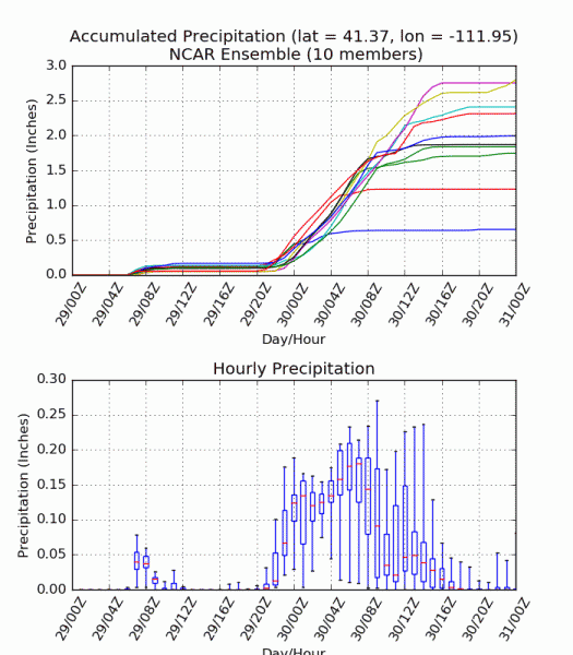
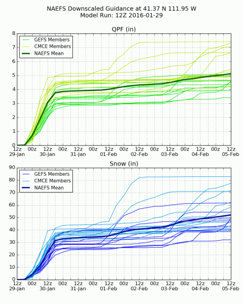
I think that tomorrow will start at considerable than become high as snow really starts to accumulate. I am interested to see how all of these new layers shake out in the Ogden Mountains. Two last photos of possible precip in the Ogden mountains which is where I could see high kicking in and I am excited to see what happens with snow and water totals!! Find these at (http://weather.utah.edu/index.php?runcode=2016012912&t=naefs&d=PL&r=BLPU1) through the University of Utah Atmospheric Science website and (http://wasatchweatherweenies.blogspot.com)