Observation Date
1/26/2016
Observer Name
Fred
Region
Salt Lake » Mill Creek Ridgeline
Location Name or Route
Mill D to Reynolds to the Nipple to Wilson Glade
Weather
Sky
Clear
Wind Direction
Northwest
Wind Speed
Light
Weather Comments
Sunny clear and realitive calm day. Cool in the shade and warm in the sun. Could see the stronger wind on the higher elevations to the south
Snow Characteristics
Snow Surface Conditions
Powder
Dense Loose
Wind Crust
Damp
Snow Characteristics Comments
In shady protected areas still mainly soft powder snow. Even east and west facing snow is somewhat preserved. South aspects are sun effected now.
Red Flags
Red Flags
Recent Avalanches
Rapid Warming
Poor Snowpack Structure
Red Flags Comments
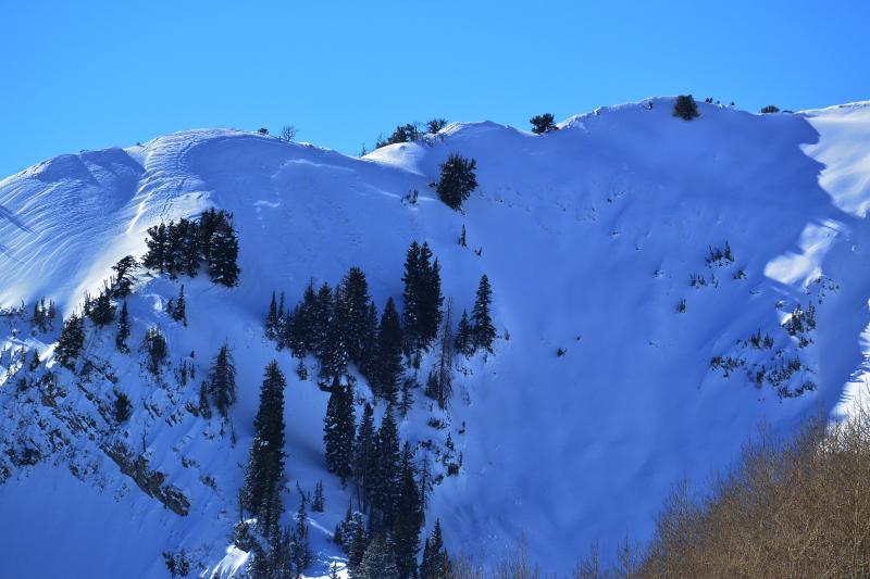
Still seeing fresh avalanches on north and east aspects.
Able to find some wind slab that will crack even well off the ridge lines
Avalanche Problem #1
Problem
Persistent Weak Layer
Trend
Same
Problem #1 Comments
The deep slab possibility is still present. Pole probing reveals poor snow pack buried down in the snow. However the slab on top is strong but still a slab.
Avalanche Problem #2
Problem
Wind Drifted Snow
Trend
Same
Problem #2 Comments
as seen today a north facing portion of a ridge coming off of gobblers knob that had wind sculpted snow around it released within the last 24 hours.
We found wind slab formed well off the ridge in the Wilson Glade as well.
Comments
Chose to ski a known repeater slide path today that had only new snow on it and a moderate slope angle. I personally would not be exposing myself to steeper terrain with the present snow pack. Besides the skiing is fun on safe terrain.
Also noted but of little surprise that the Alexander/Baker Spring east facing ridge has avalanched (east bowl) as well.
Seeing all of these slides on steeper terrain you have to rate the danger as considerable but slope angel dependent. The trick is knowing the critical angel.
Attached pic of wind slab that pulled out.
Today's Observed Danger Rating
Considerable
Tomorrows Estimated Danger Rating
Considerable