Forecast for the Moab Area Mountains

Issued by Eric Trenbeath for
Sunday, January 24, 2016
Sunday, January 24, 2016
Today the avalanche danger is MODERATE on all aspects steeper than 35 degrees in upper elevation, wind exposed terrain that have recent deposits of wind drifted snow. With snow and wind in the forecast, the danger could rise to CONSIDERABLE on steep, upper elevation slopes that face N-E-SE.
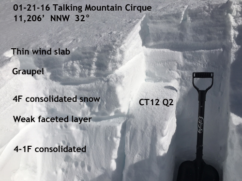
Out of the wind zone a MODERATE avalanche danger exists on steep northerly facing aspects where it may be possible to trigger a lingering, persistent slab avalanche.

Low
Moderate
Considerable
High
Extreme
Learn how to read the forecast here