I found a very different snowpack today 1000 feet higher and with a more northerly aspect. The main take-away from this is that in the Uintas this year, as is often the case, variability is high and backcountry travelers need to make constant observations to detect changes with elevation, aspect, and location. Results in one area do not guarantee the same results in another drainage, or even on the other side of the same drainage!
In the Boundary Creek area, I measured 165cm of snow, which may be on the high side due to wind activity, but certainly the snowpack here is deep enough to bury most trees and stumps and provide an excellent base for riding.
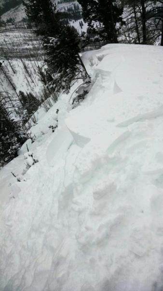
The top of the snowpack was perfectly right-side up and with the new storm snow, conditions were as good as they get. I was able to find and ski snow that was totally unaffected by yesterday's wind and therefore presented low avalanche hazard. ECT30N.
The one problem with otherwise paradisiacal vision is the massive 50cm layer of depth hoar at the bottom of the snowpack. See description in "avalanche problem #1" section for details.
As usual when a hard-to-quantify weakness like this lurks deep in the snowpack, slope angle is key. I skied 30 degrees and under all day without fear. I would not have skied a 35 degree slope with this structure, even with the stout crust overlying the depth hoar.
I am calling today's hazard "moderate", understanding that there undoubtedly many places in which the hazard was higher. Tomorrow should be the same or better since most of the hazard today was related to wind. Of course shallow snowpack areas and repeater slide paths with shallow snow are in their own class. But in "normal" terrain, hazard will be low-moderate with the depth hoar caveat.