UDOT PLANNED AVALANCHE CLOSURES!!

Forecast for the Logan Area Mountains

Toby Weed
Issued by Toby Weed on
Thursday morning, January 14, 2016

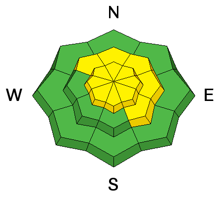
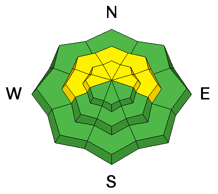
MODERATE (level 2): Expect a rising danger as we head into the weekend. Triggered wind slab avalanches are already likely today in drifted upper elevation terrain. Accumulating snow will cause a rising danger of storm slab avalanches on many slopes with preexisting very weak surface snow. Evaluate the snow and terrain carefully, and avoid steep drifted slopes at upper elevations.
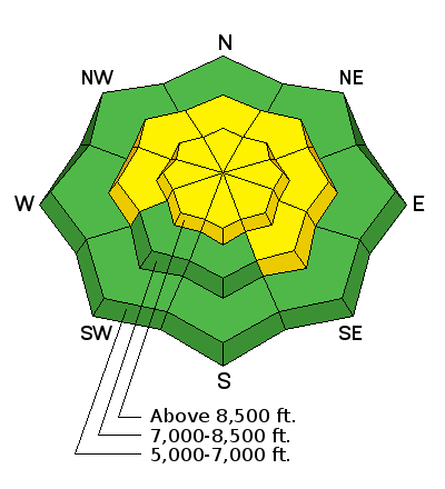
Low
Moderate
Considerable
High
Extreme
Learn how to read the forecast here
Weather and Snow

The temperature is 21 degrees and reading 2 inches of new snow from overnight at the 8400' Tony Grove Snotel. There's now 49 inches of total snow, containing 88% of average water content for the date. The 9700' CSI Logan Peak weather station reports 15 degrees and somewhat decreased west winds overnight, currently averaging in the mid teens after gusting to 38 mph early this morning.


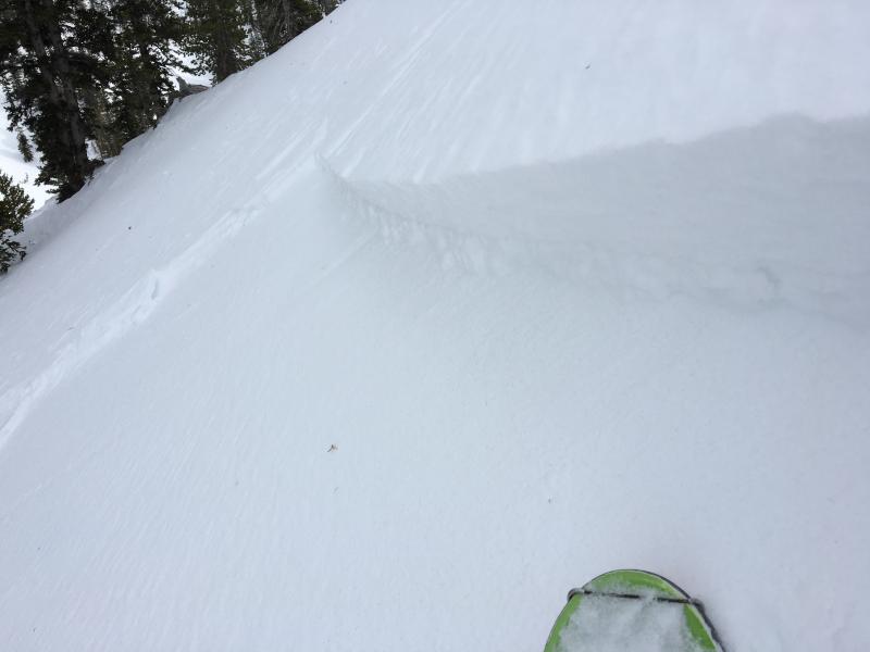
Shooting cracks like this one in a hard wind slab indicate unstable conditions. Stout wind slabs in the Mt Magog area yesterday were failing pretty easily on weak surface snow. In this case, I could see flattened surface hoar feathers on the bed surface just below the crown, but weak small-grained sugary or faceted snow is also widespread in the Logan Zone. (1-13-2016)


Recent Avalanches
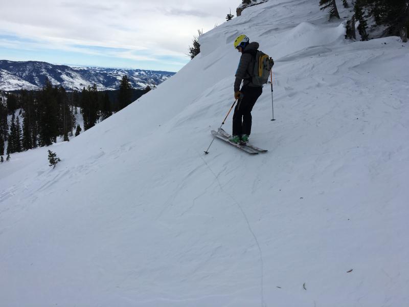
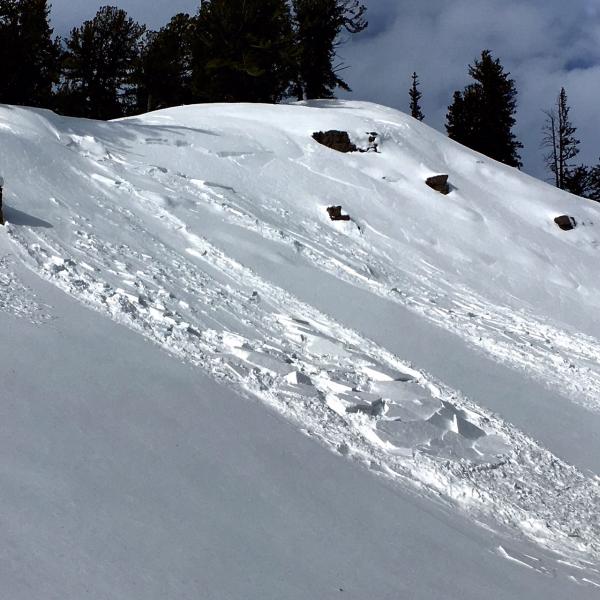
  • Natural wind slab activity occurred in the last few days at upper elevations due to drifting, and we were easily able to trigger a foot-deep hard wind slab on an upper elevation test slope yesterday in the Tony Grove Area...
  • Otherwise, it's been two weeks since the last significant avalanche in the Logan Zone.
  • A rider triggered, was caught, carried, partially buried, and injurred on New Years Eve in a large and scary avalanche on a slope with a history of avalanche accidents in the Middle Fork of St. Charles Canyon. Video Report
  • On January 4, I observed several other recent sled triggered avalanches just north of the state line in the Danish Pass Area. The very broad 2-foot-deep avalanches failed on a thin layer of weak faceted snow on top of a rime or rain crust from December 8/9.

***To view our updated list of backcountry observations and avalanche activity from around Utah, go to our observations page

Ad
Avalanche Problem #1
Wind Drifted Snow
Type
Location
Likelihood
Size
Description

Avoid stiff and perhaps hollow sounding wind slabs near ridge tops and in and around terrain features like gullies, sub-ridges, scoops, and rock outcroppings. Wind slabs may have formed on weak faceted or feathery snow that was previously on the snow surface, which means the slabs could be reactive to our weight, and the older drifts may stay sensitive to human triggering for a little while.

Yesterday's hard wind slabs rested on weak surface snow, and they were still sensitive to our weight. Hard slabs have a nasty tendency to allow you to get out on them before releasing. Although these wind slabs were pretty small, the hardness makes them less manageable, and more dangerous wind slab conditions likely exist today in some drifted upper elevation areas. (1-13-2016)

Avalanche Problem #2
New Snow
Type
Location
Likelihood
Size
Description

Loose and very weak snow can be found on the surface in many areas, and as a slab consisting of heavy new snow stacks up on it storm slab avalanches will become more likely. More snow than expected today could cause soft slab avalanches to become possible even in sheltered terrain and at lower elevations. As more snow piles up tonight and tomorrow on widespread weak snow the avalanche danger will rise significantly in the backcountry.

Additional Information

Snow is likely this morning but will tapper off for a bit this afternoon. 2 to 4 inches of accumulation is expected today, 8500' temperatures are expected to be around 23 degrees, and moderate west winds are expected. A stronger system will impact the zone tonight and last into Friday, with 5 to 11 inches of accumulation possible, temperatures around 13 degrees and southwesterly wind. The weather looks like it will continue to be productive through the weekend and remain unsettled well into next week.

General Announcements

The CROWBAR backcountry ski race will be Saturday January 30. More info at http://CrowbarSkiRace.org.

Please submit snow and avalanche observations from your ventures in the backcountry HERE. You can call us at 801-524-5304 or email HERE, or include #utavy in your Instagram or Tweet us @UAClogan. To report avalanche activity in the Logan Area or to contact the local avalanche forecaster call me, Toby, at 435-757-7578.

I'll update this advisory throughout the season on Monday, Wednesday, Friday, and Saturday mornings by about 7:30

This advisory is produced by the U.S.D.A. Forest Service, which is solely responsible for its content. It describes only general avalanche conditions and local variations always exist.