Fall Auction is now live! Check it out now

Observation: Brianhead Backcountry

Observation Date
1/8/2016
Observer Name
Leeds/Hunter
Region
Southwest » Brian Head Backcountry
Location Name or Route
Brian Head Sidecountry
Weather
Sky
Obscured
Precipitation
Moderate Snowfall
Wind Direction
North
Wind Speed
Moderate
Weather Comments
High country socked in most of the day. Moderate snowfall during the day. Wind transporting snow in the upper elevations.
Snow Characteristics
New Snow Depth
4"
New Snow Density
Low
Snow Surface Conditions
Powder
Dense Loose
Wind Crust
Snow Characteristics Comments

4" overnight, however Brian Head has received 20" or so this week, mostly in 4" impulses, not a bad way to go! Some dense drifted snow in exposed areas. Some minor wind crusts.

Some rimed snow and pellets during the day.

Red Flags
Red Flags
Heavy Snowfall
Wind Loading
Cracking
Poor Snowpack Structure
Red Flags Comments
Snow totals during the week qualify as heavy snowfall, 2" or so of water weight. Wind loading in exposed areas, areas above treeline were obscured from view most of the day. Minor localized cracking, no propagation. Poor snowpack structure in upper elevation areas, basal facets are weak and loose.
Avalanche Problem #1
Problem
Wind Drifted Snow
Trend
Same
Problem #1 Comments

Wind slabs in exposed areas. Some drifting up to 2" deep.

Moderate danger in areas traveled, I would expect pockets of considerable in areas above treeline.

Avalanche Problem #2
Problem
Persistent Weak Layer
Problem #2 Comments

Weak basal facets underlie a strong mid-pack. Good bridging but we are not out of the water yet.

Low to moderate probability but high consequence. ECTN it took full body weight to break the base of the column in an area with an HS of 140 cm.

Snow Profile
Aspect
North
Elevation
10,200'
Slope Angle
31°
Comments

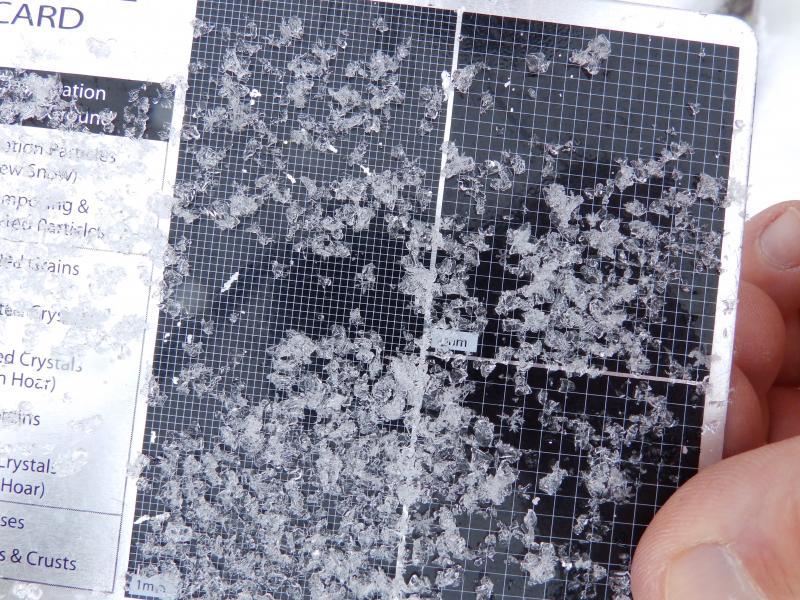
Photos below: basal facets and ECTN, after testing I broke the the column with full body weight, and I ma no lightweight! Note the consistent, strong mid-pack.

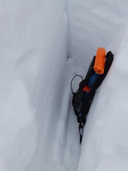
While filling in the snow pit with a ski push from above we observed some shear planes in the upper pack, minor and not reactive during ECT testing.

Overall I did not see any alarming today, I am still concerned with basal facets throughout SW Utah, I am am treating the snowpack as guilty until proven otherwise. Coming from the Wasatch, I am treating the snowpack in the Tushers and Brian Head areas as more of a continental type snowpack.

Overall a moderate danger with the potential for pockets of considerable in upper elevation wind loaded areas.

Many thanks to the Brian Head Ski Patrol for a great tour!

Forecast hazard based on worst case scenario, mostly moderate below treeline.

Today's Observed Danger Rating
Considerable
Tomorrows Estimated Danger Rating
Considerable