Forecast for the Skyline Area Mountains

Brett Kobernik
Issued by Brett Kobernik for
Friday, January 1, 2016

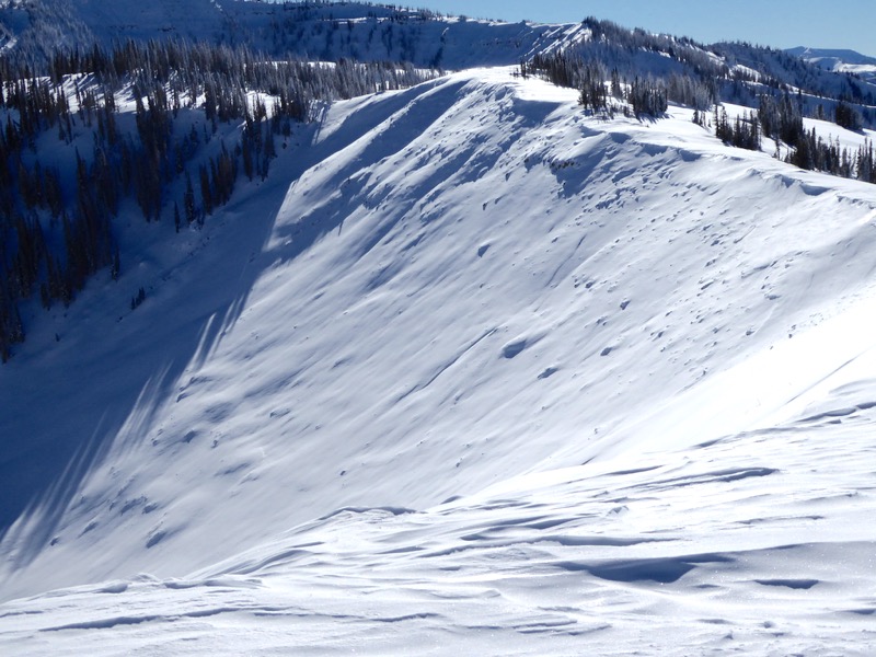
The avalanche danger remains MODERATE on slopes over 35 degrees in steepness that face west, north and east which did not avalanche during last week's natural cycle. It is more pronounced in the higher terrain that faces north through east. Chances of triggering an avalanche are low but if you do, it could be a dangerous situation. Avoid stopping below steep slopes and only put one person on a slope at a time.
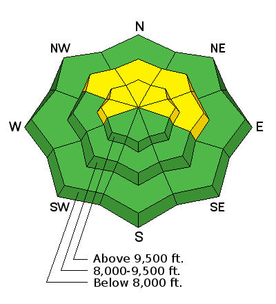
Low
Moderate
Considerable
High
Extreme
Learn how to read the forecast here
Weather and Snow

The Skyline picked up 4 to 6" from Monday through Thursday. East winds picked up late yesterday and overnight and will have done quite a bit of damage along the higher terrain.

I was out in the backcountry on Thursday viewing numerous natural avalanches that ran last week. Check out what I was finding HERE.

Recent Avalanches

Here's just one of the large avalanches that released naturally last week. Upper Seeley Creek, north bowl:

Ad
Avalanche Problem #1
Persistent Weak Layer
Type
Location
Likelihood
Size
Description

There are still slopes out there which didn't release last week that should be avoided. There's still a chance that a person could trigger a dangerous avalanche in the upper elevation terrain. Riding on or below slopes that avalanched last week is a much safer bet.

Additional Information

General Announcements

We will publish full detailed advisories Saturday and Sunday mornings by 7am. We will also be publishing basic avalanche danger ratings & info during the week.

If you are getting out into the mountains, we love to hear from you! You can SUBMIT OBSERVATIONS ONLINE or EMAIL US

If you would like to have avalanche advisories emailed to you, SIGN UP HERE

We can provide basic avalanche awareness presentations for your school, group or club. To enquire, CLICK HERE