
Forecast for the Moab Area Mountains

Issued by Eric Trenbeath on
Wednesday morning, December 23, 2015
Wednesday morning, December 23, 2015
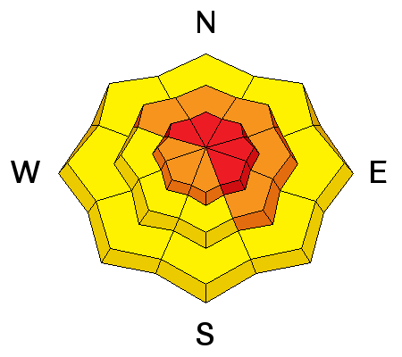
Human triggered avalanches are likely today, and the danger is HIGH in upper elevation, wind exposed terrain on slopes steeper than about 30 degrees that face NW-NE-SE. Below tree line the avalanche danger is CONSIDERABLE. Avalanches may be triggered remotely and from adjacent, lower angle slopes. Stay off of, and out from under steep terrain. Only experienced backcountry travelers with excellent route finding skills and a high level of avalanche awareness should travel in the mountains today.

Low
Moderate
Considerable
High
Extreme
Learn how to read the forecast here